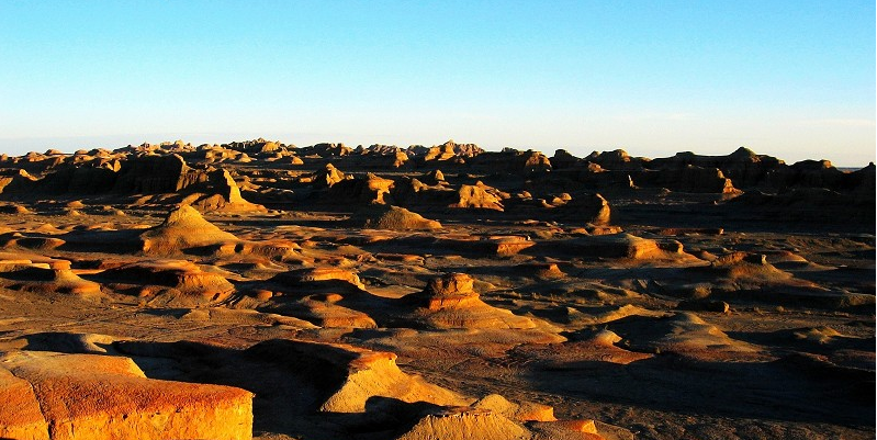
Zhungar Basin, lying between Tianshan Mountains and Altai Mountains, is characteristic of being higher in the eastern part and lower in the western part in topography with the altitudes varying from 500 meters - 1000 meters above sea level. To its west is the Zhungar Hill area and to its east is Beitashan Mountain area. And the edges of the Basin are piedmont oases with comparatively rich water resources, and these oases are the main agricultural area of Xinjiang. In the central area of it is the second largest desert of China - Kurbantonggut Desert.
Geologically, Zhungar is an old tableland with rich reserves of not only oil and natural gas but a great number of fossils of ancient extinct life, such as dinosaurs, silicified wood and so on, all of them recorded the geographic transformation of the Basin, and the basin is a rare prehistory geology museum.

In Urhe area of the northwestern part of the Basin, fossils of pterodactyl and other ancient extinct life, such as ancient turtles, crocodiles, snake-necked dinosaurs, lizard-hipped dinosaurs and bird-hipped dinosaurs, are great in number and in the eastern part of the Basin, a fossil of a huge lizard-footed dinosaurs, as long as 30 meters and another fossil of the same type of dinosaurs, more than 10 meters high and 34 meters long, were found, which are believed to be the largest of those which have been found in the world. In the same area, which is called “Jiangjun Gobi”, there is a spot of ancient sea-face fossils of ancient shells, peduncles and corals. And a large area of silicified wood has been found in the area from Jiangjun Gobi to the Zhuomao Hu, Nanhu in Hami in the east and to Urumqi, Miquan in the west. And most of them are on the ground, which from a spectacular view in the Basin.


