
20 years of pioneer in xinjiang tourism for overseas travelers
Born Here, Know Best, Your Journey's Blessed
No Shopping. No Detour, 99% Excellent Review

contact UsOn Wechat
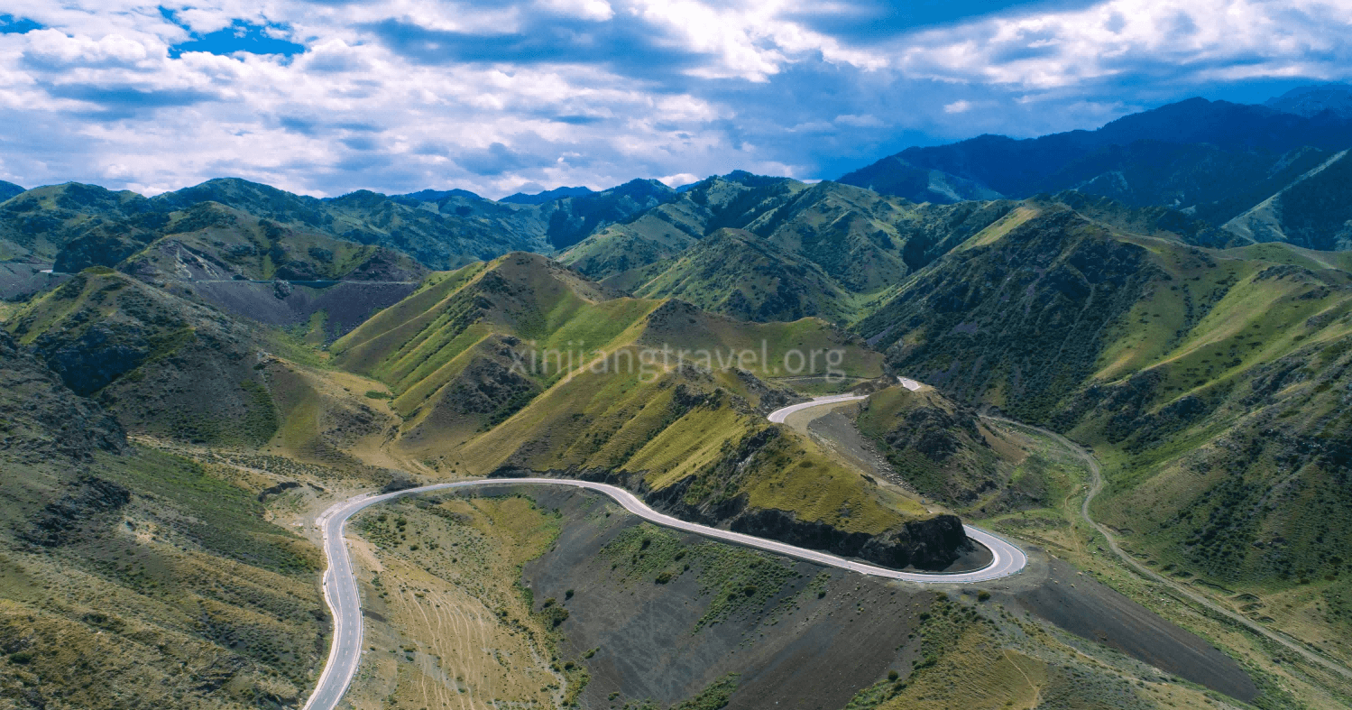
Xinjiang is a destination where the journey is often just as important as the destination.
For many years, traveling through the region meant long driving days, winding mountain roads and limited connections between some of its most spectacular landscapes. Today, a growing network of new and upgraded highways is changing that experience.
Some of these roads were built primarily to improve transportation and logistics. Others have become important tourism routes in their own right, opening up mountain valleys, grasslands and remote scenic areas to travelers.
Among the roads that deserve particular attention are:
· G577 Jinghe–Yining Highway
· G681 Altay–Hemu Highway
· G0711 Urumqi–Yuli Expressway
· G217 Duku Highway
Together, these roads reveal four very different sides of Xinjiang.
G577 provides a faster and safer route into the Ili Valley.
G681 opens a new approach to Hemu and the Kanas region.
G0711 creates a much faster connection between northern and southern Xinjiang.
And the Duku Highway remains one of China's most famous scenic driving routes.
For travelers planning a Xinjiang road trip, understanding these roads can make a major difference when deciding where to go, how long to drive and which route is most suitable for your trip.
The G577 Jinghe–Yining route is one of the most important new transportation projects in western Xinjiang.
The highway begins near Shashanzi in Jinghe County, connecting with the G30 Lianhuo Expressway, and ends near Subutai Township in Nilka County, where it connects with G578.
The route is approximately 92.5 kilometers long.
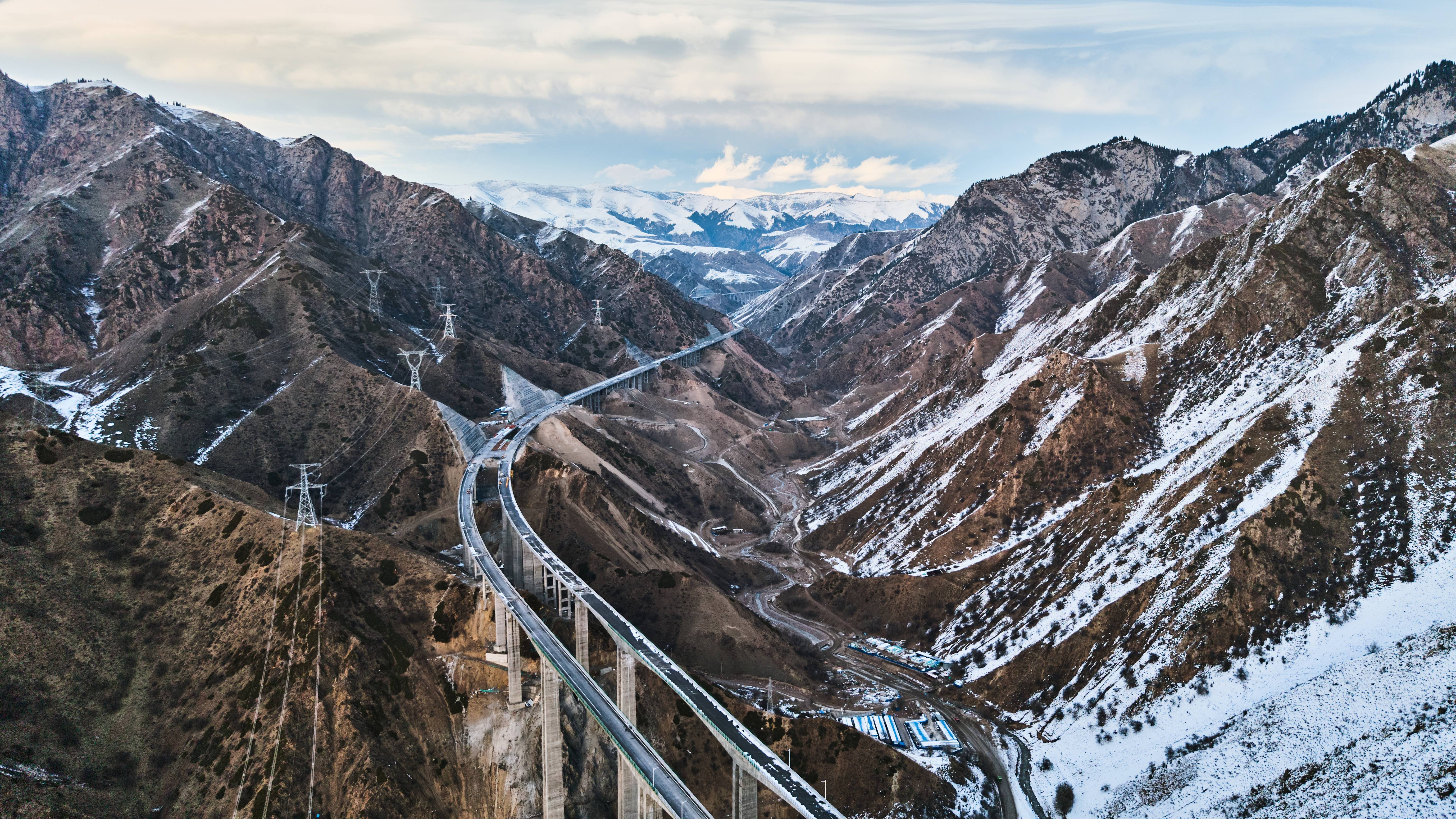
It is designed as a four-lane first-class highway with a design speed of 100 km/h. Almost half of the route consists of bridges and tunnels, reflecting the difficult mountainous terrain through which it passes.
The traditional route into the Ili Valley through the Guozigou area can be affected by:
· Heavy snowfall
· Avalanches
· Landslides
· Difficult mountain conditions
G577 provides another major transportation corridor into the Ili Valley.
One of its most important advantages is that it reduces dependence on the more vulnerable sections around Guozigou.
For travelers, this means that access to the Ili region can become:
· Faster
· More reliable
· More comfortable
The new route reduces the driving distance between Urumqi and Yining by approximately 90 kilometers and can reduce the journey from around eight hours to just over six hours under suitable conditions.
The mountainous terrain makes G577 particularly impressive from an engineering perspective.
Approximately 49.16% of the route consists of bridges and tunnels.
Two major structures stand out.
The tunnel is approximately:
11.88 kilometers long
It is one of the key engineering structures on the route.
Instead of climbing repeatedly over difficult mountain terrain, travelers can now pass directly through the Tianshan range.
The bridge is approximately:
938 meters long
Its highest main pier reaches around:
144 meters
These structures demonstrate how modern infrastructure is changing transportation across Xinjiang's mountainous regions.
Unlike the Duku Highway, G577 should not be viewed primarily as a sightseeing road.
Its greatest value for tourists is that it makes the Ili Valley easier to reach.
For travelers planning a route through:
· Yining
· Nalati
· Zhaosu
· Nilka
· Sayram Lake
G577 can be an important part of the overall transportation network.
The road itself may not be the main attraction, but the time saved on transportation can give travelers more time to explore the Ili Valley.
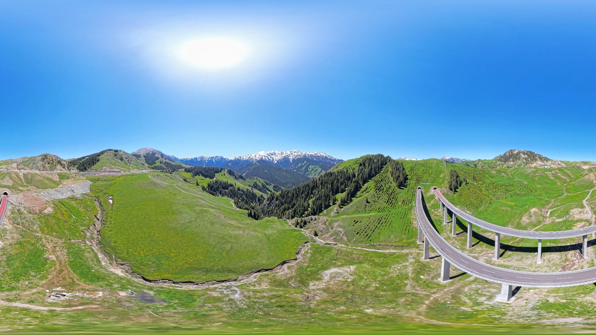
A practical route might be:
Urumqi → Jinghe → G577 → Ili Valley → Yining
From Yining, travelers can continue toward:
· Sayram Lake
· Nalati
· Zhaosu
· Tekes
· Qapqal
This makes G577 particularly useful for travelers who want to combine efficient transportation with an Ili-focused itinerary.
If G577 is primarily about improving access, G681 is much more closely connected with tourism.
The G681 runs from Altay City to Hemu Village in Burqin County's Hemu Kazakh Township.
The route is approximately:
209.45 kilometers
It is classified as a mountainous third-class highway, with a 7.5-meter roadbed and 6.5-meter pavement width.

The Altay region is home to some of Xinjiang's most famous landscapes:
· Kanas
· Hemu
· Altay Mountains
· Grasslands
· Forests
· Alpine valleys
Previously, reaching these destinations could involve long journeys from major transportation hubs.
G681 helps create a larger tourism transportation loop.
It connects:
Altay → Hemu → Burqin → Altay
This creates an important tourism circulation route in the region.
One of the most interesting features of G681 is that the road has been developed with tourism in mind.
Around 31 parking and viewing areas have been constructed along the route.
These provide access to landscapes including:
· Wuxilike Wetland Park
· Tongba Primeval Forest
· Tolehite Grassland
· Yileke Stone Forest
This means travelers do not necessarily have to treat the road as a simple point-to-point transfer.
The journey itself can become part of the sightseeing experience.
The new route has reduced the journey from Altay City to Hemu from approximately:
6 hours → 3 hours
under normal road conditions.
For tourists, this is a major improvement.
It means a traveler staying in Altay can reach Hemu much more efficiently, while a longer northern Xinjiang itinerary can be organized with greater flexibility.
The road passes through a landscape very different from southern Xinjiang.
Expect:
· Dense forests
· Open grasslands
· Mountain valleys
· Rock formations
· Seasonal wetlands
The scenery changes significantly with elevation and season.
In summer, grasslands can be particularly green.
In autumn, the Altay Mountains become famous for golden forests.
This makes the road particularly attractive to photographers.
Although the route can be useful during different seasons, autumn is one of the most visually impressive periods.
The forests around the Altay region develop intense golden and yellow colors.
For photographers, a route such as:
Altay → G681 → Hemu → Kanas → Burqin
can become one of the highlights of a northern Xinjiang journey.
A practical itinerary could be:
Altay → Hemu → Kanas → Burqin
or:
Urumqi → Altay → Hemu → Kanas → Burqin → Urho → Yining
The exact route should depend on road conditions, seasonal opening and the amount of time available.
G0711 is completely different from the previous two roads.
This is a major expressway connecting northern and southern Xinjiang.
The route starts at the Xishannan Interchange on Urumqi's western ring expressway and ends in Yuli County.
The total length is approximately:
324.7 kilometers
It is a four-lane expressway designed for speeds of up to 120 km/h.
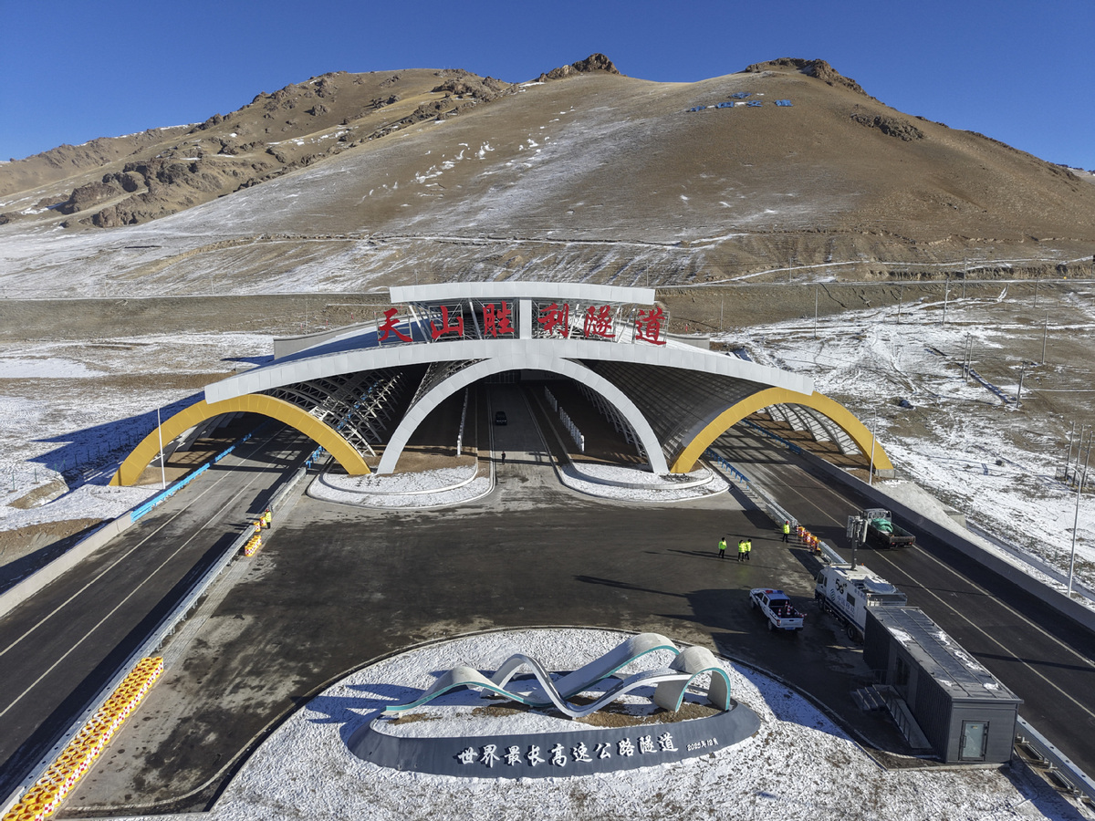
The most famous structure on the route is the:
Tianshan Shengli Tunnel
The tunnel is approximately:
22.13 kilometers long
It is described in the supplied reference material as the world's longest expressway tunnel.
The project used an unusual engineering approach involving:
· Three tunnels
· Four vertical shafts
The construction created several engineering records, including an extremely deep vertical shaft.
The Tianshan Mountains form one of the most important geographical barriers in Xinjiang.
Historically, crossing the mountains could require a long journey.
G0711 creates a much faster connection.
The driving time between Urumqi and Korla has been reduced from approximately:
7 hours → 3.5 hours
under normal conditions.
This road is particularly useful for travelers planning a journey from:
Urumqi → Korla → Kuqa → Aksu → Kashgar
Instead of spending an entire day traveling from Urumqi to Korla, travelers can reach the southern side of the Tianshan Mountains much faster.
That creates more time for destinations such as:
· Bosten Lake
· Korla
· Kuqa
· Kizil Thousand-Buddha Caves
· Tianshan Grand Canyon
· Taklamakan Desert
Like G577, G0711 should not be confused with a dedicated scenic highway.
The biggest benefit for tourists is:
Time saved.
For a 7-10 day Xinjiang itinerary, reducing a major transfer from seven hours to approximately three and a half can make a significant difference.
That extra time can be used for sightseeing rather than sitting in a vehicle.
The Duku Highway is perhaps the best-known road on this list.
Unlike G577 and G0711, the Duku Highway is itself a major tourism attraction.
The route is part of:
G217 National Highway
and connects:
Dushanzi in the north → Kuqa in the south
The entire Duku Highway is approximately:
561 kilometers
long.
The section between Nalati and Bayinbuluke is particularly famous and is regarded as one of the scenic highlights of the route.
The biggest attraction of the Duku Highway is the extraordinary change in scenery.
A single road trip can pass through:
· Alpine mountains
· Snowfields
· Forests
· Grasslands
· River valleys
· Deep gorges
The elevation changes dramatically along the route.
This creates the feeling of traveling through several different geographical regions within a single day.
The section between Nalati and Bayinbuluke is especially popular.
The route connects two famous grassland destinations:
Nalati Grassland
and
Bayinbuluke Grassland
The scenery includes:
· Rolling grasslands
· Snow-covered mountains
· Rivers
· Forested mountain slopes
It is particularly attractive in summer.
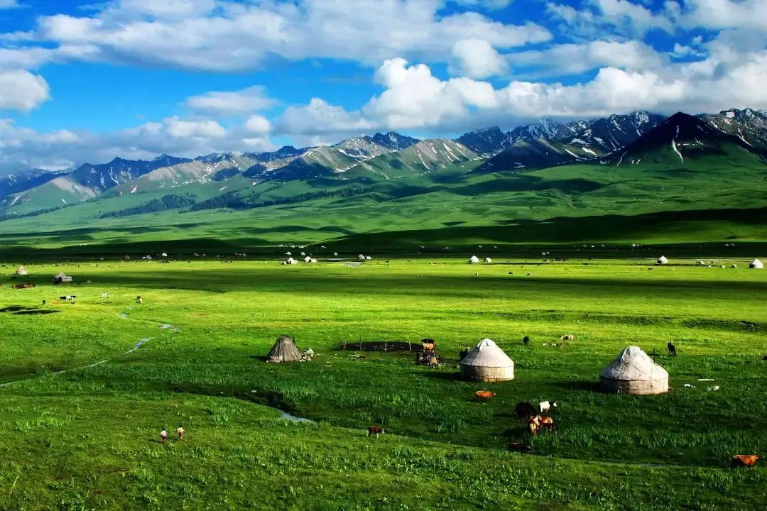
Nalati is one of the most famous grassland destinations in Xinjiang.
The landscape combines:
· Green alpine meadows
· Snow mountains
· Rivers
· Kazakh pastoral culture
Travelers can spend time exploring the grassland before continuing toward Bayinbuluke.
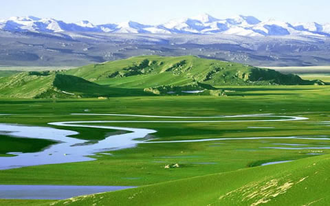
Bayinbuluke is famous for its enormous grassland landscape.
One of the best-known sights is the Nine Bends and Eighteen Turns of the Kaidu River.
At sunset, the river can reflect the sky and create multiple shining curves across the grassland.
This is one of the most recognizable photographic scenes along the Duku route.
The Duku Highway crosses high mountain terrain and is strongly affected by weather.
Unlike ordinary highways, it is not normally open throughout the winter.
The reference material notes that the road is generally open only during the warmer months, approximately June to October, with traffic restrictions during winter. Actual opening and closing dates can vary according to snow, weather and road conditions.
Therefore, anyone planning a Duku Highway road trip should check the latest traffic information before departure.
Not every road serves the same purpose.
You want to:
· Reach the Ili Valley efficiently
· Travel between Jinghe and Yining
· Avoid relying entirely on the traditional Guozigou route
You want to:
· Explore Altay
· Visit Hemu
· Travel around Kanas
· Experience northern Xinjiang forests and grasslands
You want to:
· Travel from northern to southern Xinjiang
· Reduce the Urumqi–Korla driving time
· Combine northern and southern Xinjiang in one trip
You want:
· A true road-trip experience
· Mountain scenery
· Grasslands
· Photography
· One of China's most famous scenic drives
The real advantage of these roads becomes clear when they are combined into a larger itinerary.
Urumqi → Altay → Hemu → Kanas → Burqin → Urho → Yining
G681 can be used to improve access between Altay and Hemu.
The route combines:
· Forests
· Lakes
· Grasslands
· Mountains
· Kazakh culture
Urumqi → Jinghe → G577 → Yining → Sayram Lake → Nalati → Zhaosu → Yining
This route focuses on:
· Ili Valley
· Alpine grasslands
· Lakes
· Snow mountains
G577 makes the transportation section between the northern gateway and Ili Valley more efficient.
Dushanzi → Duku Highway → Nalati → Bayinbuluke → Kuqa
This is the route for travelers who want the road itself to be the main attraction.
The journey combines:
· Tianshan mountains
· Forests
· Grasslands
· High mountain passes
· Southern Xinjiang landscapes
A longer journey can combine the new expressway with scenic roads.
For example:
Urumqi → Ili → Northern Xinjiang → Urumqi → G0711 → Korla → Kuqa → Kashgar
G0711 can significantly shorten the northern-to-southern transfer.
This allows travelers to experience two very different sides of Xinjiang:
Northern Xinjiang
· Lakes
· Forests
· Grasslands
· Snow mountains
Southern Xinjiang
· Deserts
· Ancient cities
· Islamic architecture
· Silk Road heritage
A road can be famous without being suitable for every traveler.
When planning your journey, consider:
· Season
· Road opening status
· Driving distance
· Weather
· Altitude
· Number of driving hours
· Scenic stops
A good Xinjiang road trip should balance driving and sightseeing.
Xinjiang is enormous.
A common mistake is planning a route based only on the distance between cities.
A 300-kilometer journey in Xinjiang can feel completely different from a 300-kilometer journey in eastern China.
Mountain roads, weather and sightseeing stops all affect the actual travel time.
For scenic routes such as the Duku Highway and G681, it is better to allow additional time for:
· Viewpoints
· Photography
· Short walks
· Unexpected weather conditions
This is especially important for:
Duku Highway
and other high-altitude mountain routes.
Road conditions can change because of:
· Snow
· Heavy rain
· Landslides
· Temperature changes
Always confirm current traffic conditions before setting out.
Xinjiang's transportation network is developing rapidly.
New highways and tunnels are making once-difficult journeys significantly easier.
But the most interesting thing is that these roads are doing more than simply reducing driving times.
They are changing the way travelers can design their routes.
G577 makes the Ili Valley more accessible.
G681 strengthens the tourism network around Altay, Hemu and Kanas.
G0711 makes crossing the Tianshan Mountains much faster.
And the Duku Highway remains a reminder that sometimes the road itself can be the destination.
For travelers, this means Xinjiang is becoming easier to explore without losing the sense of scale and adventure that makes the region so special.
A Xinjiang road trip requires more than simply connecting destinations on a map.
The route needs to take into account:
· Seasonal road conditions
· Realistic driving times
· Mountain weather
· Scenic stops
· Hotel locations
· Vehicle requirements
· Local road regulations
Silk Road Travel can arrange customized private road trips throughout Xinjiang, including:
· Northern Xinjiang road trips
· Ili Valley tours
· Kanas and Hemu journeys
· Duku Highway tours
· Southern Xinjiang road trips
· Cross-region Xinjiang itineraries
· Private vehicles
· English-speaking guides
· Hotel arrangements
Whether you want to drive through the forests of Altay, cross the grasslands of the Ili Valley, experience the Duku Highway or travel from northern to southern Xinjiang through the Tianshan Mountains, Silk Road Travel can design a route around your schedule, interests and preferred travel pace.
Silk Road Travel
Email: info@silkroadtravel.com
Phone / WhatsApp: +86 15909912575
Take the road less traveled and discover Xinjiang one landscape at a time.
Xinjiang is a destination where the journey is often just as important as the destination.
For many years, traveling through the region meant long driving days, winding mountain roads and limited connections between some of its most spectacular landscapes. Today, a growing network of new and upgraded highways is changing that experience.
Some of these roads were built primarily to improve transportation and logistics. Others have become important tourism routes in their own right, opening up mountain valleys, grasslands and remote scenic areas to travelers.
Among the roads that deserve particular attention are:
· G577 Jinghe–Yining Highway
· G681 Altay–Hemu Highway
· G0711 Urumqi–Yuli Expressway
· G217 Duku Highway
Together, these roads reveal four very different sides of Xinjiang.
G577 provides a faster and safer route into the Ili Valley.
G681 opens a new approach to Hemu and the Kanas region.
G0711 creates a much faster connection between northern and southern Xinjiang.
And the Duku Highway remains one of China's most famous scenic driving routes.
For travelers planning a Xinjiang road trip, understanding these roads can make a major difference when deciding where to go, how long to drive and which route is most suitable for your trip.
The G577 Jinghe–Yining route is one of the most important new transportation projects in western Xinjiang.
The highway begins near Shashanzi in Jinghe County, connecting with the G30 Lianhuo Expressway, and ends near Subutai Township in Nilka County, where it connects with G578.
The route is approximately 92.5 kilometers long.
It is designed as a four-lane first-class highway with a design speed of 100 km/h. Almost half of the route consists of bridges and tunnels, reflecting the difficult mountainous terrain through which it passes.
The traditional route into the Ili Valley through the Guozigou area can be affected by:
· Heavy snowfall
· Avalanches
· Landslides
· Difficult mountain conditions
G577 provides another major transportation corridor into the Ili Valley.
One of its most important advantages is that it reduces dependence on the more vulnerable sections around Guozigou.
For travelers, this means that access to the Ili region can become:
· Faster
· More reliable
· More comfortable
The new route reduces the driving distance between Urumqi and Yining by approximately 90 kilometers and can reduce the journey from around eight hours to just over six hours under suitable conditions.
The mountainous terrain makes G577 particularly impressive from an engineering perspective.
Approximately 49.16% of the route consists of bridges and tunnels.
Two major structures stand out.
The tunnel is approximately:
11.88 kilometers long
It is one of the key engineering structures on the route.
Instead of climbing repeatedly over difficult mountain terrain, travelers can now pass directly through the Tianshan range.
The bridge is approximately:
938 meters long
Its highest main pier reaches around:
144 meters
These structures demonstrate how modern infrastructure is changing transportation across Xinjiang's mountainous regions.
Unlike the Duku Highway, G577 should not be viewed primarily as a sightseeing road.
Its greatest value for tourists is that it makes the Ili Valley easier to reach.
For travelers planning a route through:
· Yining
· Nalati
· Zhaosu
· Nilka
· Sayram Lake
G577 can be an important part of the overall transportation network.
The road itself may not be the main attraction, but the time saved on transportation can give travelers more time to explore the Ili Valley.
A practical route might be:
Urumqi → Jinghe → G577 → Ili Valley → Yining
From Yining, travelers can continue toward:
· Sayram Lake
· Nalati
· Zhaosu
· Tekes
· Qapqal
This makes G577 particularly useful for travelers who want to combine efficient transportation with an Ili-focused itinerary.
If G577 is primarily about improving access, G681 is much more closely connected with tourism.
The G681 runs from Altay City to Hemu Village in Burqin County's Hemu Kazakh Township.
The route is approximately:
209.45 kilometers
It is classified as a mountainous third-class highway, with a 7.5-meter roadbed and 6.5-meter pavement width.
The Altay region is home to some of Xinjiang's most famous landscapes:
· Kanas
· Hemu
· Altay Mountains
· Grasslands
· Forests
· Alpine valleys
Previously, reaching these destinations could involve long journeys from major transportation hubs.
G681 helps create a larger tourism transportation loop.
It connects:
Altay → Hemu → Burqin → Altay
This creates an important tourism circulation route in the region.
One of the most interesting features of G681 is that the road has been developed with tourism in mind.
Around 31 parking and viewing areas have been constructed along the route.
These provide access to landscapes including:
· Wuxilike Wetland Park
· Tongba Primeval Forest
· Tolehite Grassland
· Yileke Stone Forest
This means travelers do not necessarily have to treat the road as a simple point-to-point transfer.
The journey itself can become part of the sightseeing experience.
The new route has reduced the journey from Altay City to Hemu from approximately:
6 hours → 3 hours
under normal road conditions.
For tourists, this is a major improvement.
It means a traveler staying in Altay can reach Hemu much more efficiently, while a longer northern Xinjiang itinerary can be organized with greater flexibility.
The road passes through a landscape very different from southern Xinjiang.
Expect:
· Dense forests
· Open grasslands
· Mountain valleys
· Rock formations
· Seasonal wetlands
The scenery changes significantly with elevation and season.
In summer, grasslands can be particularly green.
In autumn, the Altay Mountains become famous for golden forests.
This makes the road particularly attractive to photographers.
Although the route can be useful during different seasons, autumn is one of the most visually impressive periods.
The forests around the Altay region develop intense golden and yellow colors.
For photographers, a route such as:
Altay → G681 → Hemu → Kanas → Burqin
can become one of the highlights of a northern Xinjiang journey.
A practical itinerary could be:
Altay → Hemu → Kanas → Burqin
or:
Urumqi → Altay → Hemu → Kanas → Burqin → Urho → Yining
The exact route should depend on road conditions, seasonal opening and the amount of time available.
G0711 is completely different from the previous two roads.
This is a major expressway connecting northern and southern Xinjiang.
The route starts at the Xishannan Interchange on Urumqi's western ring expressway and ends in Yuli County.
The total length is approximately:
324.7 kilometers
It is a four-lane expressway designed for speeds of up to 120 km/h.
The most famous structure on the route is the:
Tianshan Shengli Tunnel
The tunnel is approximately:
22.13 kilometers long
It is described in the supplied reference material as the world's longest expressway tunnel.
The project used an unusual engineering approach involving:
· Three tunnels
· Four vertical shafts
The construction created several engineering records, including an extremely deep vertical shaft.
The Tianshan Mountains form one of the most important geographical barriers in Xinjiang.
Historically, crossing the mountains could require a long journey.
G0711 creates a much faster connection.
The driving time between Urumqi and Korla has been reduced from approximately:
7 hours → 3.5 hours
under normal conditions.
This road is particularly useful for travelers planning a journey from:
Urumqi → Korla → Kuqa → Aksu → Kashgar
Instead of spending an entire day traveling from Urumqi to Korla, travelers can reach the southern side of the Tianshan Mountains much faster.
That creates more time for destinations such as:
· Bosten Lake
· Korla
· Kuqa
· Kizil Thousand-Buddha Caves
· Tianshan Grand Canyon
· Taklamakan Desert
Like G577, G0711 should not be confused with a dedicated scenic highway.
The biggest benefit for tourists is:
Time saved.
For a 7-10 day Xinjiang itinerary, reducing a major transfer from seven hours to approximately three and a half can make a significant difference.
That extra time can be used for sightseeing rather than sitting in a vehicle.
The Duku Highway is perhaps the best-known road on this list.
Unlike G577 and G0711, the Duku Highway is itself a major tourism attraction.
The route is part of:
G217 National Highway
and connects:
Dushanzi in the north → Kuqa in the south
The entire Duku Highway is approximately:
561 kilometers
long.
The section between Nalati and Bayinbuluke is particularly famous and is regarded as one of the scenic highlights of the route.
The biggest attraction of the Duku Highway is the extraordinary change in scenery.
A single road trip can pass through:
· Alpine mountains
· Snowfields
· Forests
· Grasslands
· River valleys
· Deep gorges
The elevation changes dramatically along the route.
This creates the feeling of traveling through several different geographical regions within a single day.
The section between Nalati and Bayinbuluke is especially popular.
The route connects two famous grassland destinations:
Nalati Grassland
and
Bayinbuluke Grassland
The scenery includes:
· Rolling grasslands
· Snow-covered mountains
· Rivers
· Forested mountain slopes
It is particularly attractive in summer.
Nalati is one of the most famous grassland destinations in Xinjiang.
The landscape combines:
· Green alpine meadows
· Snow mountains
· Rivers
· Kazakh pastoral culture
Travelers can spend time exploring the grassland before continuing toward Bayinbuluke.
Bayinbuluke is famous for its enormous grassland landscape.
One of the best-known sights is the Nine Bends and Eighteen Turns of the Kaidu River.
At sunset, the river can reflect the sky and create multiple shining curves across the grassland.
This is one of the most recognizable photographic scenes along the Duku route.
The Duku Highway crosses high mountain terrain and is strongly affected by weather.
Unlike ordinary highways, it is not normally open throughout the winter.
The reference material notes that the road is generally open only during the warmer months, approximately June to October, with traffic restrictions during winter. Actual opening and closing dates can vary according to snow, weather and road conditions.
Therefore, anyone planning a Duku Highway road trip should check the latest traffic information before departure.
Not every road serves the same purpose.
You want to:
· Reach the Ili Valley efficiently
· Travel between Jinghe and Yining
· Avoid relying entirely on the traditional Guozigou route
You want to:
· Explore Altay
· Visit Hemu
· Travel around Kanas
· Experience northern Xinjiang forests and grasslands
You want to:
· Travel from northern to southern Xinjiang
· Reduce the Urumqi–Korla driving time
· Combine northern and southern Xinjiang in one trip
You want:
· A true road-trip experience
· Mountain scenery
· Grasslands
· Photography
· One of China's most famous scenic drives
The real advantage of these roads becomes clear when they are combined into a larger itinerary.
Urumqi → Altay → Hemu → Kanas → Burqin → Urho → Yining
G681 can be used to improve access between Altay and Hemu.
The route combines:
· Forests
· Lakes
· Grasslands
· Mountains
· Kazakh culture
Urumqi → Jinghe → G577 → Yining → Sayram Lake → Nalati → Zhaosu → Yining
This route focuses on:
· Ili Valley
· Alpine grasslands
· Lakes
· Snow mountains
G577 makes the transportation section between the northern gateway and Ili Valley more efficient.
Dushanzi → Duku Highway → Nalati → Bayinbuluke → Kuqa
This is the route for travelers who want the road itself to be the main attraction.
The journey combines:
· Tianshan mountains
· Forests
· Grasslands
· High mountain passes
· Southern Xinjiang landscapes
A longer journey can combine the new expressway with scenic roads.
For example:
Urumqi → Ili → Northern Xinjiang → Urumqi → G0711 → Korla → Kuqa → Kashgar
G0711 can significantly shorten the northern-to-southern transfer.
This allows travelers to experience two very different sides of Xinjiang:
Northern Xinjiang
· Lakes
· Forests
· Grasslands
· Snow mountains
Southern Xinjiang
· Deserts
· Ancient cities
· Islamic architecture
· Silk Road heritage
A road can be famous without being suitable for every traveler.
When planning your journey, consider:
· Season
· Road opening status
· Driving distance
· Weather
· Altitude
· Number of driving hours
· Scenic stops
A good Xinjiang road trip should balance driving and sightseeing.
Xinjiang is enormous.
A common mistake is planning a route based only on the distance between cities.
A 300-kilometer journey in Xinjiang can feel completely different from a 300-kilometer journey in eastern China.
Mountain roads, weather and sightseeing stops all affect the actual travel time.
For scenic routes such as the Duku Highway and G681, it is better to allow additional time for:
· Viewpoints
· Photography
· Short walks
· Unexpected weather conditions
This is especially important for:
Duku Highway
and other high-altitude mountain routes.
Road conditions can change because of:
· Snow
· Heavy rain
· Landslides
· Temperature changes
Always confirm current traffic conditions before setting out.
Xinjiang's transportation network is developing rapidly.
New highways and tunnels are making once-difficult journeys significantly easier.
But the most interesting thing is that these roads are doing more than simply reducing driving times.
They are changing the way travelers can design their routes.
G577 makes the Ili Valley more accessible.
G681 strengthens the tourism network around Altay, Hemu and Kanas.
G0711 makes crossing the Tianshan Mountains much faster.
And the Duku Highway remains a reminder that sometimes the road itself can be the destination.
For travelers, this means Xinjiang is becoming easier to explore without losing the sense of scale and adventure that makes the region so special.
A Xinjiang road trip requires more than simply connecting destinations on a map.
The route needs to take into account:
· Seasonal road conditions
· Realistic driving times
· Mountain weather
· Scenic stops
· Hotel locations
· Vehicle requirements
· Local road regulations
Silk Road Travel can arrange customized private road trips throughout Xinjiang, including:
· Northern Xinjiang road trips
· Ili Valley tours
· Kanas and Hemu journeys
· Duku Highway tours
· Southern Xinjiang road trips
· Cross-region Xinjiang itineraries
· Private vehicles
· English-speaking guides
· Hotel arrangements
Whether you want to drive through the forests of Altay, cross the grasslands of the Ili Valley, experience the Duku Highway or travel from northern to southern Xinjiang through the Tianshan Mountains, Silk Road Travel can design a route around your schedule, interests and preferred travel pace.
Silk Road Travel
Email: info@silkroadtravel.com
Phone / WhatsApp: +86 15909912575
Take the road less traveled and discover Xinjiang one landscape at a time.


