
20 years of pioneer in xinjiang tourism for overseas travelers
Born Here, Know Best, Your Journey's Blessed
No Shopping. No Detour, 99% Excellent Review

contact UsOn Wechat
.png&w=1920&q=85)
Original by: 阳光二哥
Brief Introduction to Northern Xinjiang’s Main Scenic Areas: Xinjiang is vast. The Tianshan Mountains generally form the dividing line between North and South Xinjiang. Influenced by warm, moist air currents from westerlies, the North is relatively wetter with more rain. This nurtures many natural landscapes like forests, grasslands, and lakes. The most famous are the Kanas Lake tourism area and the Ili Grasslands tourism area. Tourism here developed earlier, and facilities are relatively mature and complete. Planes, trains, and highways can reach the scenic spots directly. In comparison, many places in South Xinjiang need better transportation and tourism development. North Xinjiang means mountains and grasslands; South Xinjiang means deserts and Gobi. North Xinjiang means horses and songs; South Xinjiang means Muqam music and dance. The areas introduced here, except for Korla which is strictly in the South, all belong to the North. They cover almost all the famous scenic spots, hence the name “Northern Xinjiang Panoramic Grand Loop Tour.”
Important Notes for Foreigners Traveling in Xinjiang: Xinjiang’s stability needs are well known. Foreigners visiting should follow the rules. 1) In principle, foreigners can visit all scenic spots except Baihaba Village in Kanas. However, many places require a permit to enter. The rules for Bayinbuluke are especially strict. Foreign tourists must provide their itinerary, passport, and proof from a travel agency to the tourism bureau 3 months in advance. Then, they must take this approval to the foreign affairs bureau to get the permit. Without it, you will be turned back at the security checkpoint. So, foreigners basically cannot travel by self-drive. You must use a travel agency and plan far in advance, ideally six months or more. 2) During your trip, please do not ask about sensitive topics like ethnic policies or military matters. Do not casually comment on the country’s stability measures, and do not take photos of security facilities or personnel. Please be aware that public conversations may be recorded, and staff are required to report suspicious behavior. In short, focus on enjoying nature and avoid discussing other issues!
Is it Safe to Travel in Xinjiang? Generally speaking: Very safe! Xinjiang now has comprehensive security and stability facilities at all levels. The emergency response capability is faster and stronger than in the US, making major incidents extremely unlikely. Therefore, guides might jokingly tell you that Xinjiang is now the safest place in China!
Which Travel Agency to Use? It depends on the person. Simply put, for similar basic itineraries, the service level and cost for domestic vs. international agencies vary greatly. Take this 13-day tour as an example: many domestic groups quote 5,000–6,000 RMB, providing mostly 3-star service for dining, accommodation, and transport. The international group I recently joined, run by an agency for foreigners, cost over 12,000 RMB. It provided 5-star service throughout and was worth the money. So, please choose according to your needs.
Should You Tip? Generally, domestic groups don’t require or expect tips. However, international groups, especially those with Americans, often do, as they know tipping is standard on US tours. The amount varies, around $4–$6 per person per day total. A suggested ratio for the guide and driver is 6:4.
Best Time to Visit: Autumn is certainly the best. The leaves around Kanas change color, making the mountains colorful and incredibly beautiful. Spring is next best, with pleasant weather. The plains aren’t too hot yet, and the highland grasslands are green. Summer can be very hot in the plains, and winter sees heavy snow blocking the mountains.
Suggested Trip Duration: To see the main sights of Northern Xinjiang, 12–15 days is best. If time is short, there are many 3–7 day tour options available.
Cost Estimate (per person, excluding international airfare): This is closely related to the domestic vs. international agency mentioned earlier. A domestic group with 3-star service can be as low as 5,000–6,000 RMB per person. An international group with 5-star service can be 10,000–20,000 RMB, or even higher.
Travel Agency Recommendations: Here is one high-end and one mid-range option for reference only.
High-end: Xinjiang China International Travel Agency Co., Ltd. Address: Room 1802, No. 276 Guangming Road, Urumqi, Xinjiang. Tel: +86 13565834056 or 15699206236. Contact: Li Jing. Website: www.toursxinjiang.com or www.silkroadtravel.com
Note: Our recent 13-day trip was arranged by Lesley. It included 5-star hotels throughout, a luxury bus, good meals, and a top-notch guide. A perfect journey. The cost was about 12,500 RMB, including two flights within Xinjiang. Tips were extra. Everyone in our group of 18 gave it rave reviews and highly recommends Lesley’s company!
Mid-range: Retirement Club, 1st Floor, Building 3, No. 1436 Changning Road, Shanghai. Tel: 62260755, 62262567. The 12-day tour costs about 5,600 RMB for members. No tips.
Note: This information was obtained from regular retirees in Shanghai and is for reference only.
13-Day Itinerary Guide: Here is a classic Northern Xinjiang panoramic route, visiting the main scenic spots. This loop includes a flight at the beginning and end. Due to weather, the flight from Kanas in the north to Urumqi is closed in winter and opens around June 10th. If you start earlier, you can first fly to the southern city of Korla and travel northwards. If the northern flight is open, you can also fly to Kanas Airport first and travel southwards. Here is the route traveling from south to north.
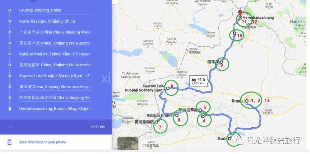
Day 1: Arrive in Urumqi.
Day 2: Visit Heavenly Lake (Tianchi).
Day 3: Fly to Korla early in the morning, sightsee there in the afternoon.
Day 4: Go to Bayinbuluke (350 km, 6 hours).
Day 5: Go to Nalati Grassland (150 km, 3 hours).
Day 6: Go to Kalajun Scenic Area (350 km, 6 hours).
Day 7: Go to Xiatan (200 km, 3 hours), then to Yining.
Day 8: Visit Sayram Lake and Guozigou Valley (450 km, 6 hours).
Day 9: Visit Ghost City (Devil City) and Five Color Beach (460 km, 6 hours).
Day 10: Go to Kanas (180 km, 4 hours).
Day 11: Kanas to Hemu (70 km, 2 hours).
Day 12: Hemu to Kanas Airport (80 km, 2.5 hours).
Day 13: Fly back to Urumqi, sightsee locally, end of trip.
Day 1: Fly to Urumqi
Fly to Urumqi today. The travel agency will pick you up from the airport and take you to the hotel. If you have time, you can go out and explore on your own.
Day 2: One-Day Tour of Heavenly Lake (Tianchi)
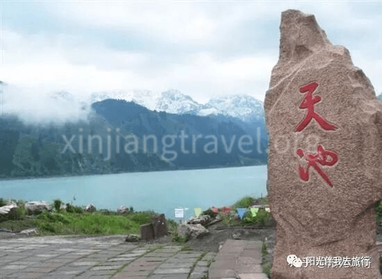
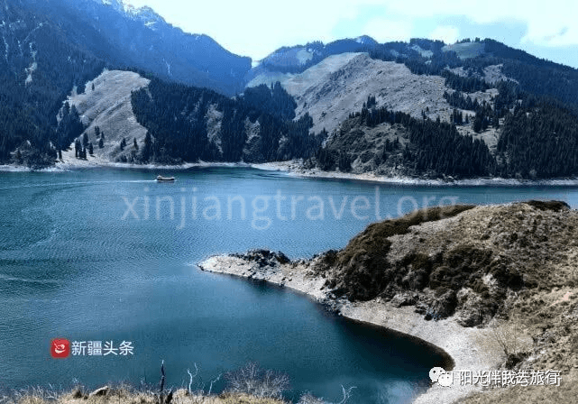
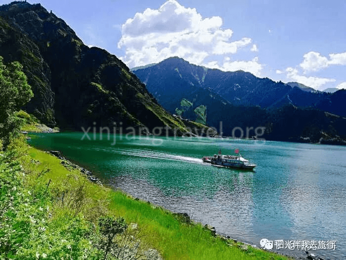
Heavenly Lake is a national 5A-level scenic area, one of China’s top ten scenic spots, and a World Natural Heritage site. Historically known as “Yaochi” (Jade Pool), it is 97 km from Urumqi. The scenic area covers 548 square km. The lake surface is at an altitude of 1,910 meters. It is 3.5 km long from north to south and 0.8–1.5 km wide from east to west, with a maximum depth of 103 meters. The lake water is like a mirror, reflecting the snow-capped peaks. It is characterized by rich snow mountains, glaciers, alpine lakes, and surrounding spruce forests, forming a vertical natural landscape belt. It is one of the must-visit best scenic spots in Xinjiang.
Unfortunately, I haven’t had the chance to visit Heavenly Lake yet. Here is a one-day itinerary from Ctrip for reference:
08:30: Take a bus to the “Pearl of Tianshan” - Heavenly Lake Scenic Area.
10:00: Sightseeing at Heavenly Lake.
13:30: Lunch.
14:20: Continue sightseeing at Heavenly Lake.
16:50: Free time at Heavenly Lake (about 1 hour 40 minutes).
18:30: Return by bus (travel time about 1 hour 30 minutes).
20:00: End of the one-day tour.
Day 3: The City of Pears, Korla
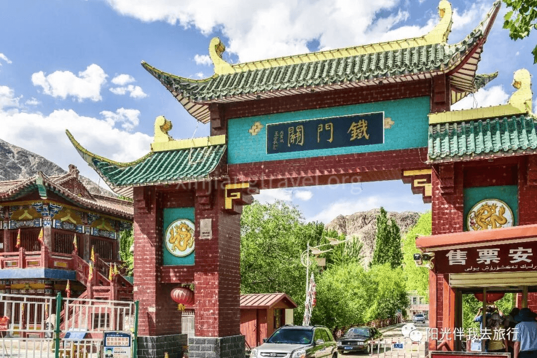
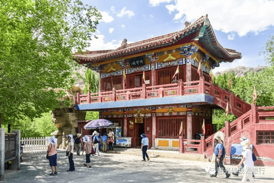
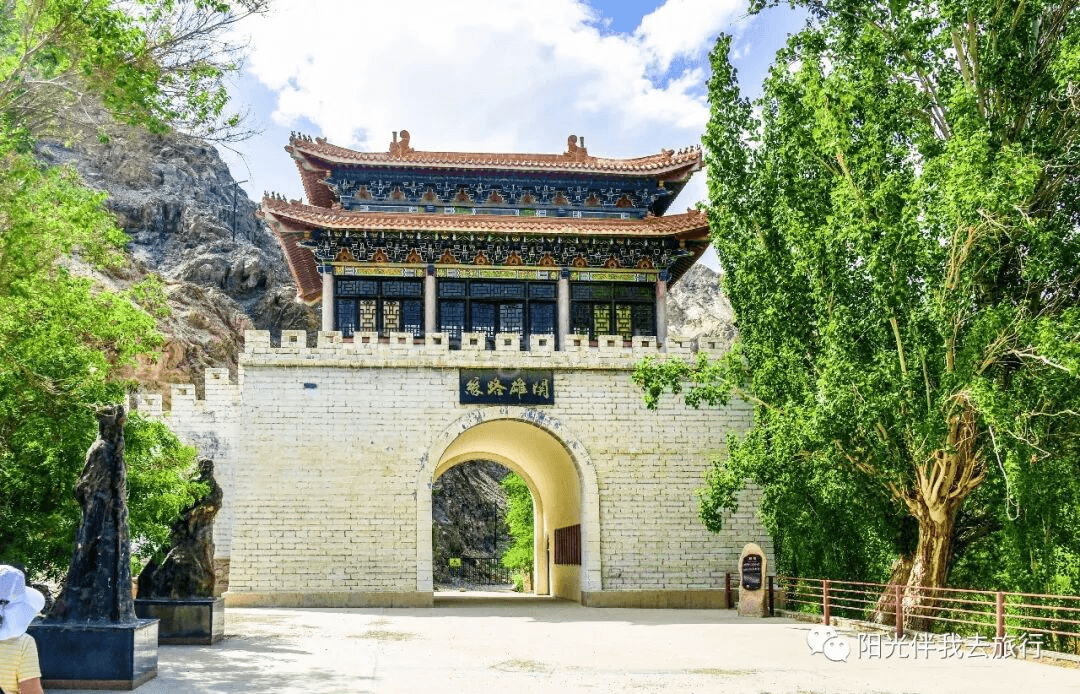
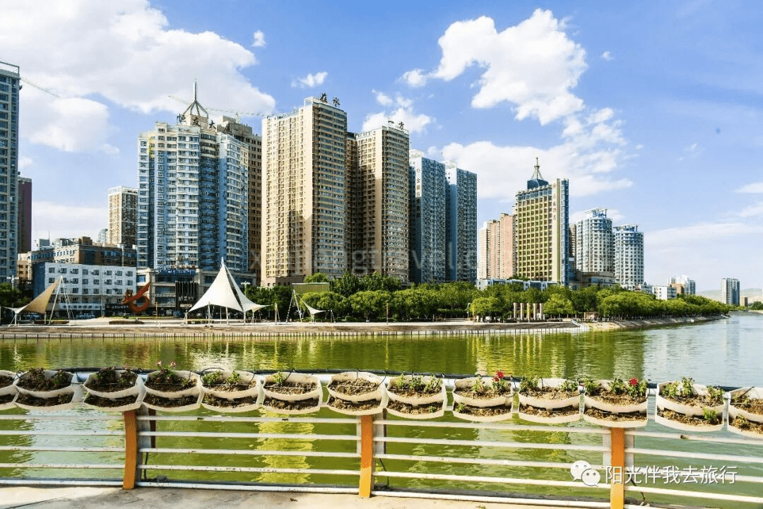
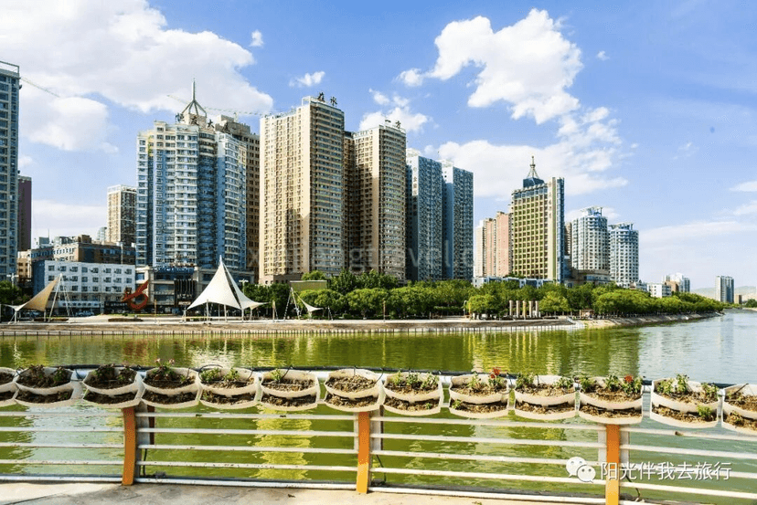
Early on the third day, fly to Korla, a major town in central Xinjiang, arriving around noon. Korla is the capital of the Bayingolin Mongol Autonomous Prefecture. It was a key stop on the ancient Silk Road and is a cradle of Western Region culture. It is an important transportation hub and distribution center for goods between North and South Xinjiang, as well as a political, economic, and cultural center. The famous fragrant pears are produced here, hence the name “City of Pears.” Korla itself doesn’t have many historical sites or natural scenery worth a special trip. However, it is a key transportation hub, so starting the loop tour from here is very convenient. The main scenic spots in Korla are the Iron Gate Pass and the Peacock River.
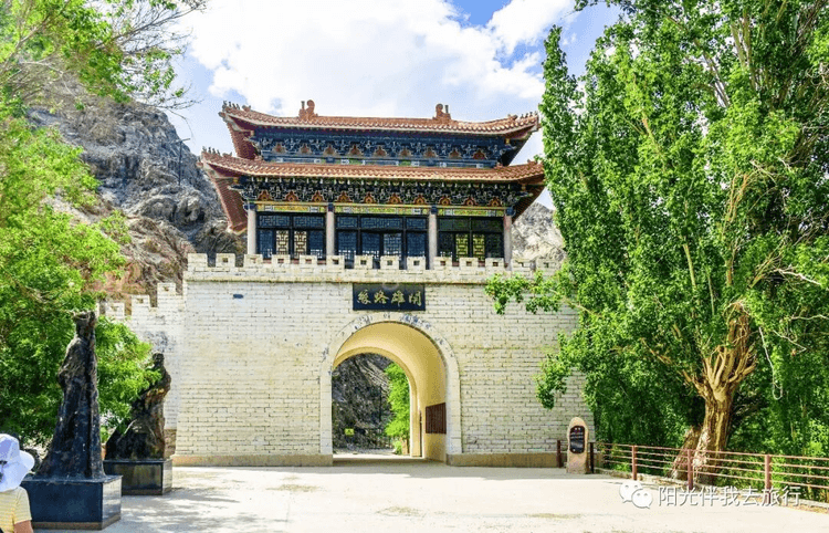
Iron Gate Pass – A major historical site in Korla. It was a perilous pass on the ancient Silk Road, a strategic choke point. A pass was established here during the Jin Dynasty, named Iron Gate Pass due to its steepness and solidity. Zhang Qian of the Western Han Dynasty passed here on his mission to the Western Regions, and Ban Chao also watered his horses at the Peacock River, which is why people also call it the “Horse-Watering River.”
Stay overnight in a Korla hotel.
Day 4: Bayinbuluke
“Bayinbuluke” means “abundant springs” in Mongolian. It is a high-mountain basin in the middle section of the Tianshan Mountains, surrounded by snow peaks. The altitude is about 2,500 meters, and the grassland covers 24,000 square km. It is China’s second-largest grassland after the Ordos in Inner Mongolia. The vast grassland is like a giant green carpet covering the earth, undulating and endless. Famous sights here include the “Nine Turns and Eighteen Bends” of the Kaidu River, famous for the sunset reflecting in the water and the colorful clouds. There is also the elegant Swan Lake and flocks of cattle and sheep all over the mountains. Every summer, flowers bloom on the grassland, and hundreds of thousands of cattle, sheep, horses, yaks, and camels graze on the green grass. The scene is spectacular.
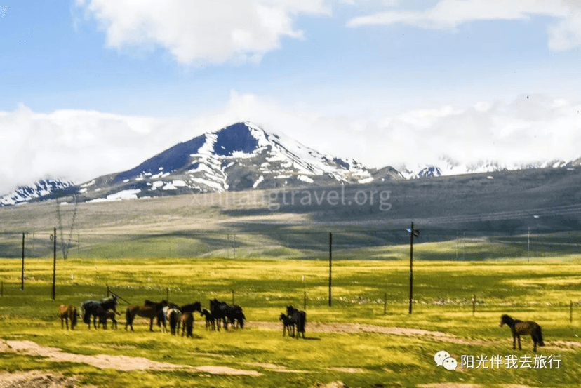
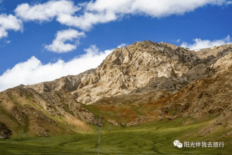
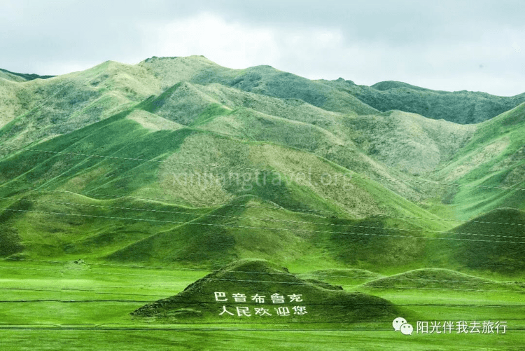
The drive from Korla takes about 6 hours. After leaving the city, the landscape gradually changes to vast grasslands and snow mountains, becoming more and more beautiful. Suddenly, you’ll see the slogan “The People of Bayinbuluke Welcome You” on the grassy slopes!
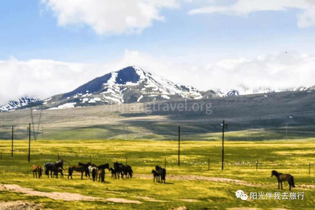
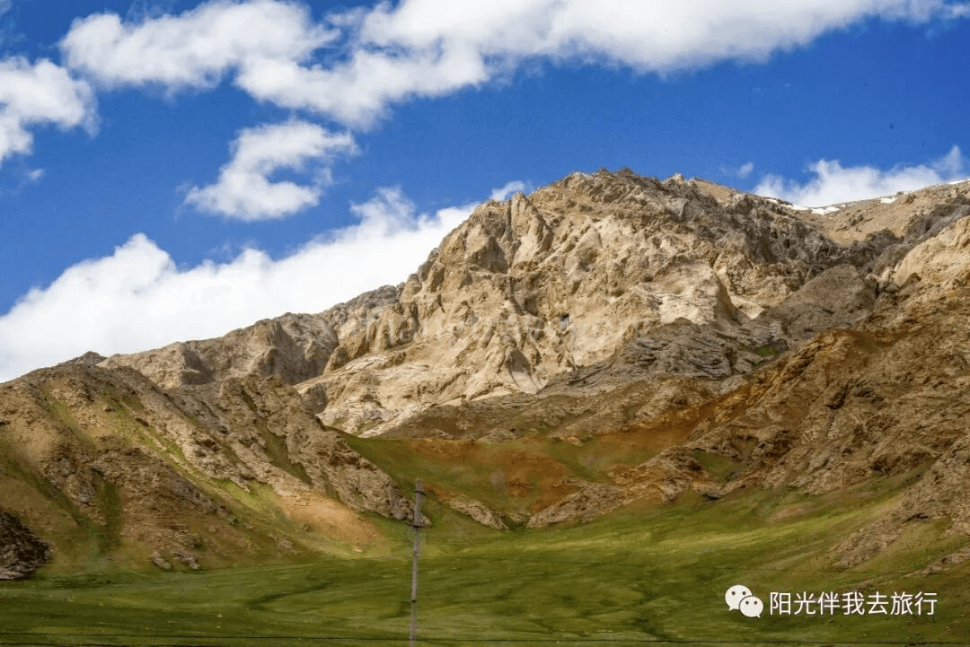
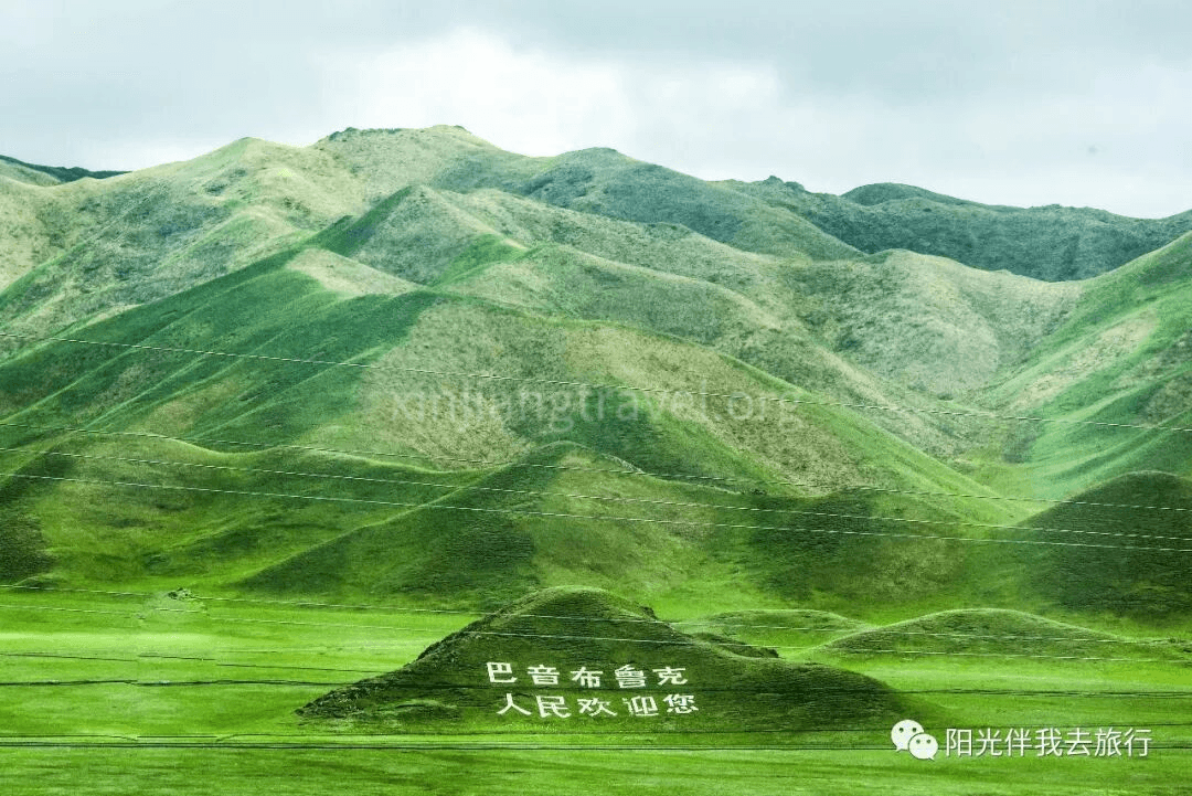
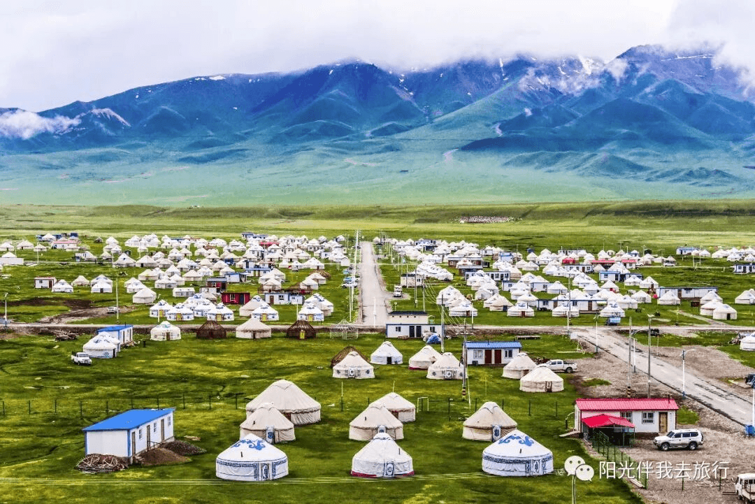
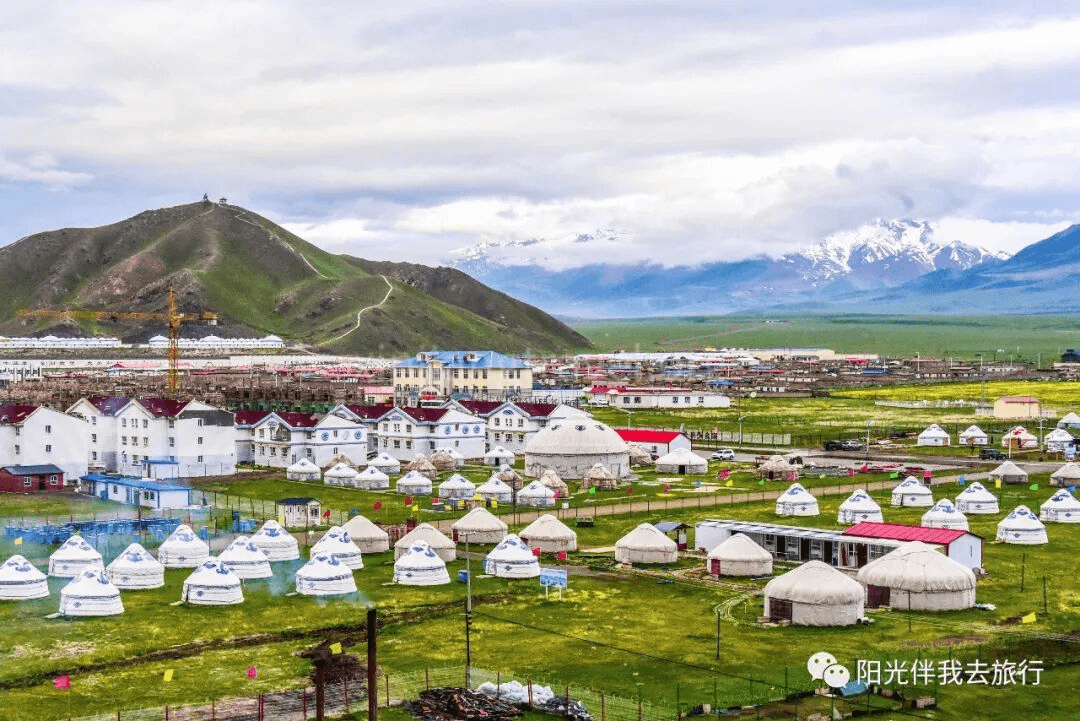
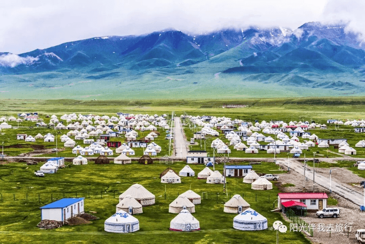
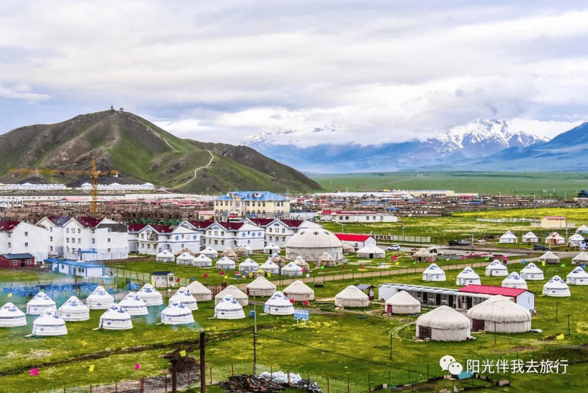
Bayinbuluke Town – Entering the town, you’ll see colorful yurts of all kinds spread across the grass. It’s very picturesque.
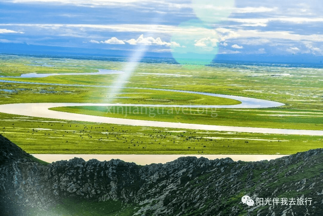
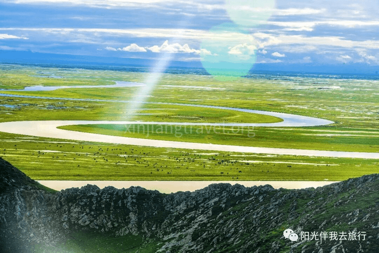
Nine Turns and Eighteen Bends of the Kaidu River – The Kaidu River is one of Xinjiang’s major rivers, over 500 km long. It flows through the Bayinbuluke grassland, covering 22,000 square km. The source is shrouded in clouds. Especially in midsummer, it’s hard to tell where the clouds end and the water begins, as if the river falls from the sky. On the flat, vast grassland of the Little Yuldus Basin, the Kaidu River meanders, forming the spectacular “Nine Turns and Eighteen Bends.” The scenery changes with the seasons. From September to October, the sun sets directly on the central axis of the bends, reflecting nine suns in the water. This is the legendary “Nine Suns Linked Together” scene, truly spectacular. However, it’s very difficult to witness.
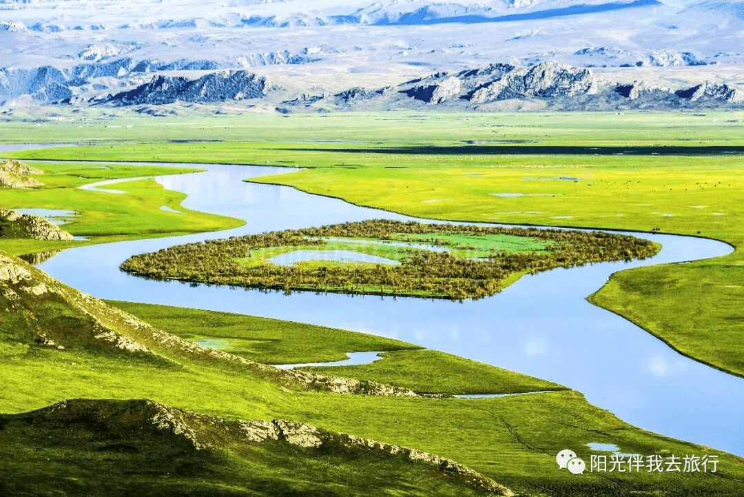
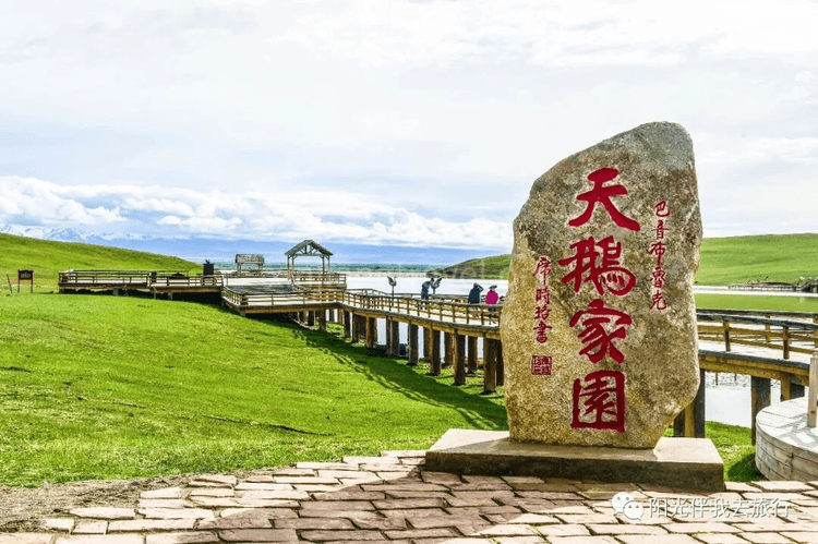
Swan Lake – Another spot on the Bayinbuluke grassland. It is said to be Asia’s largest and China’s only swan nature reserve, home to China’s largest population of wild swans. Every spring when flowers bloom, over 10,000 rare birds, including whooper swans, little swans, and mute swans, fly here from as far away as India, Myanmar, Pakistan, and even the Black Sea, Red Sea, and Mediterranean coasts to breed. When winter comes, they fly south over the Himalayas. So, seeing swans here depends on the season. If the time isn’t right, there won’t be many swans. For example, when I went in early June, I only saw a few swans lazily resting on the grass.
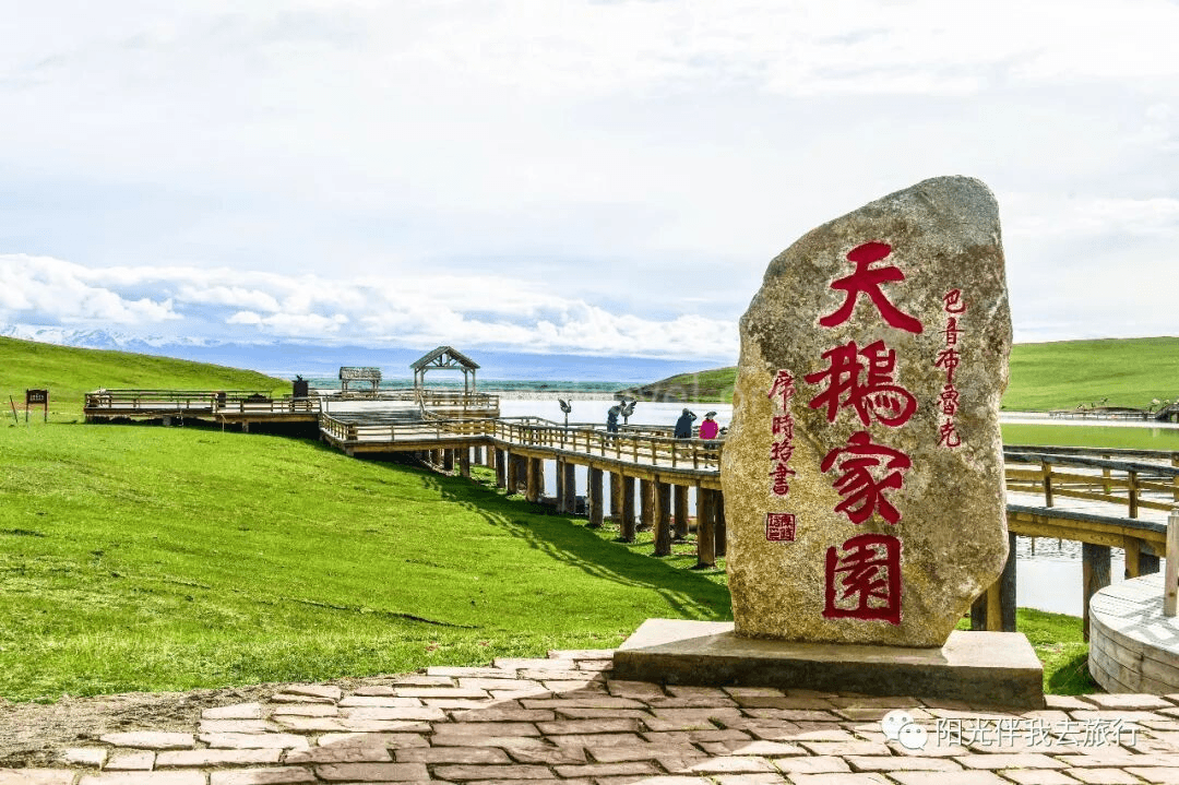
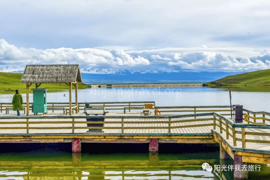
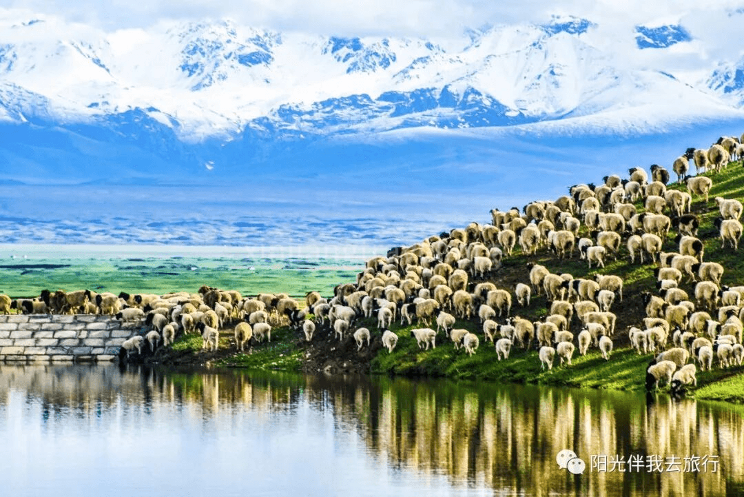
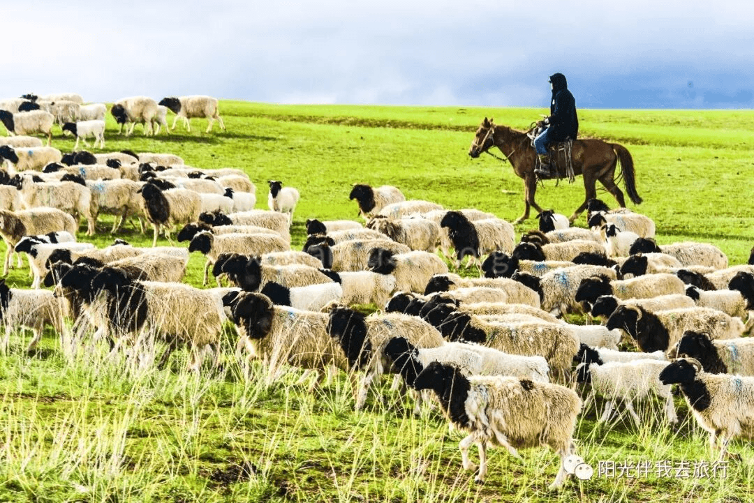
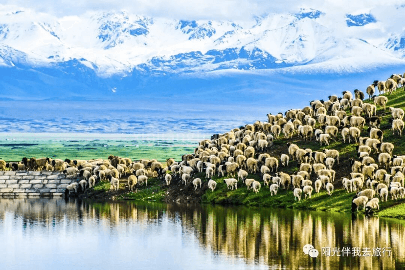
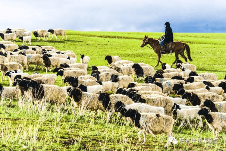
Instead, I saw a heavenly scene here – under the backdrop of distant snow mountains, large flocks of sheep were drinking and playing by the lake under the watch of their shepherds.
Stay overnight in a hotel in Bayinbuluke Town.
Day 5: Nalati Grassland
Nalati Grassland means “Green Valley” in Mongolian and “White Sun Slope” in Kazakh. It is located east of Nalati Town, Xinyuan County, Ili Prefecture. It is one of the world’s four major grasslands. It has been a famous pasture since ancient times. The beautiful grassland scenery combined with Kazakh folk customs makes it one of Xinjiang’s top ten scenic areas, a national 5A-level scenic spot, and a key brand scenic area.
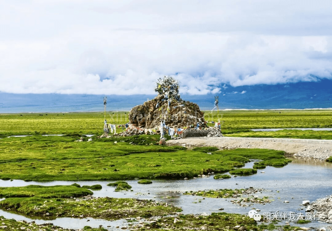
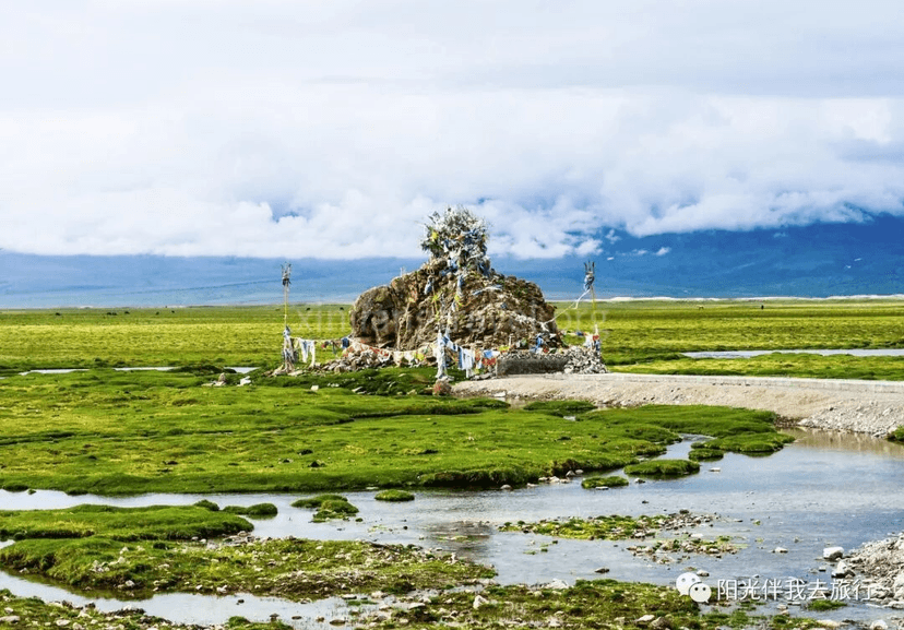
Along the way – It’s only 150 km from Bayinbuluke to Nalati, a 3-hour drive. The scenery is beautiful and pleasant. I also saw an “ovoo” (a stone heap used as a shrine or landmark) for the first time, though it didn’t look as romantic as in the song “Meeting at the Ovoo.”
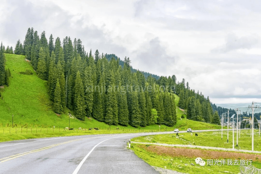
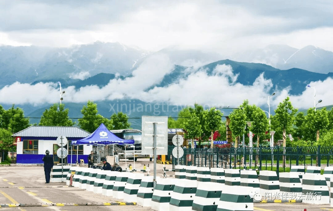
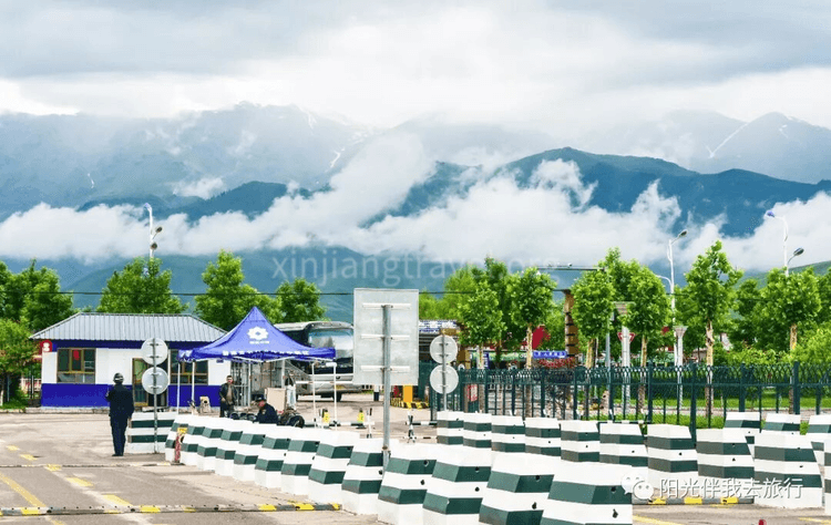
Scenic Area Management Center – Arrive at the entrance of the Nalati Grassland. Here, you transfer to a scenic area bus. The scenery here is already quite charming.
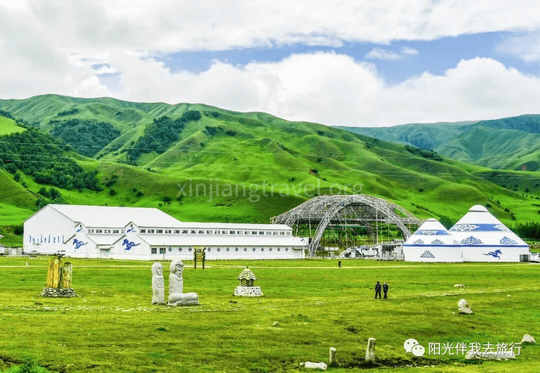
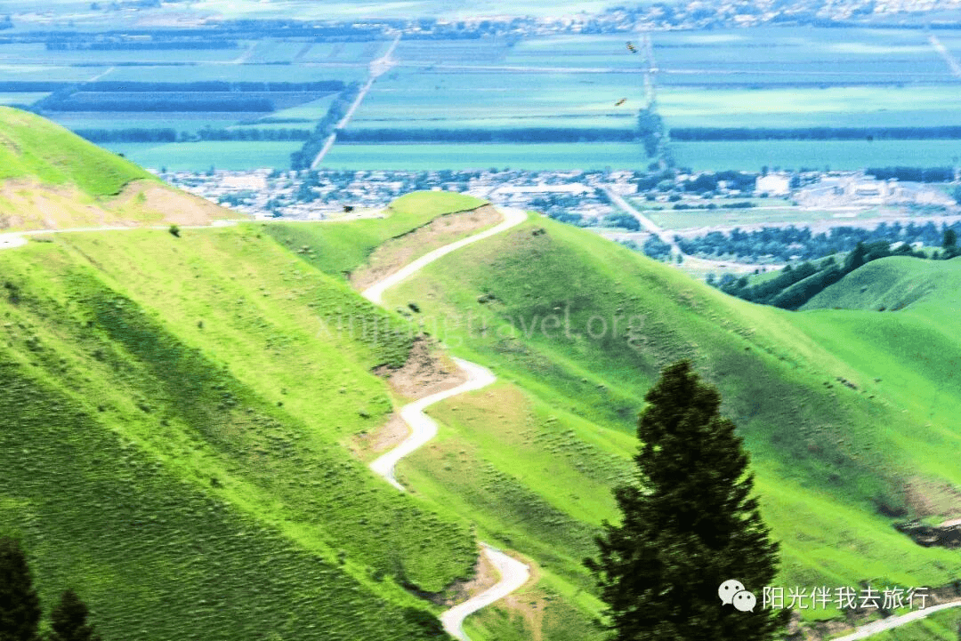
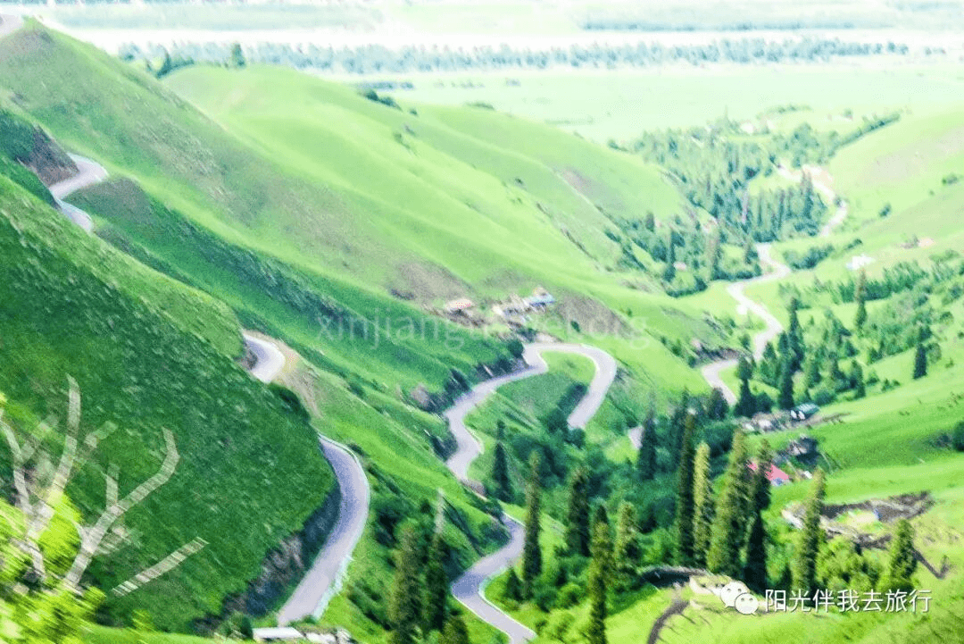
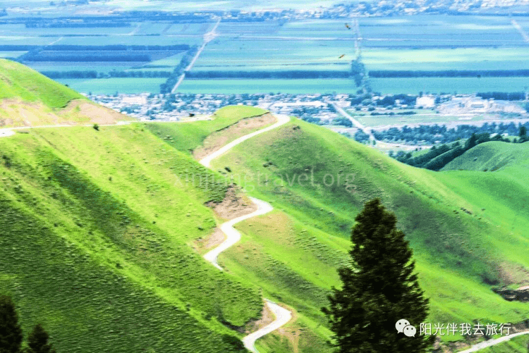
sland Scenery – The bus leaves the main gate and travels about 30 km to the scenic area center. It passes a section of winding mountain road with beautiful scenery on both sides. After entering the high mountain pasture, it becomes flat and incredibly open.
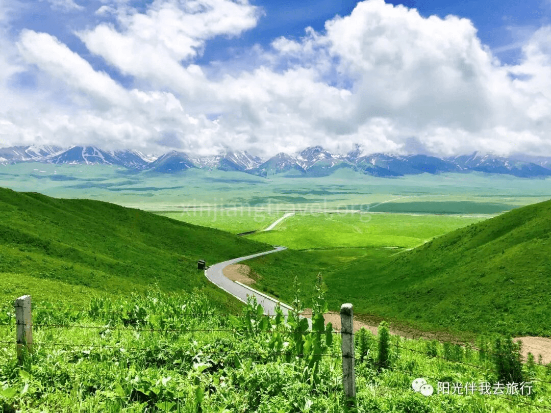
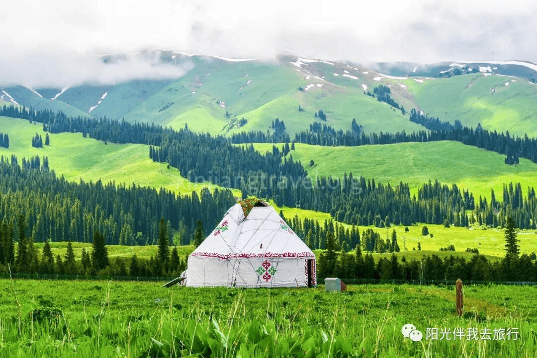
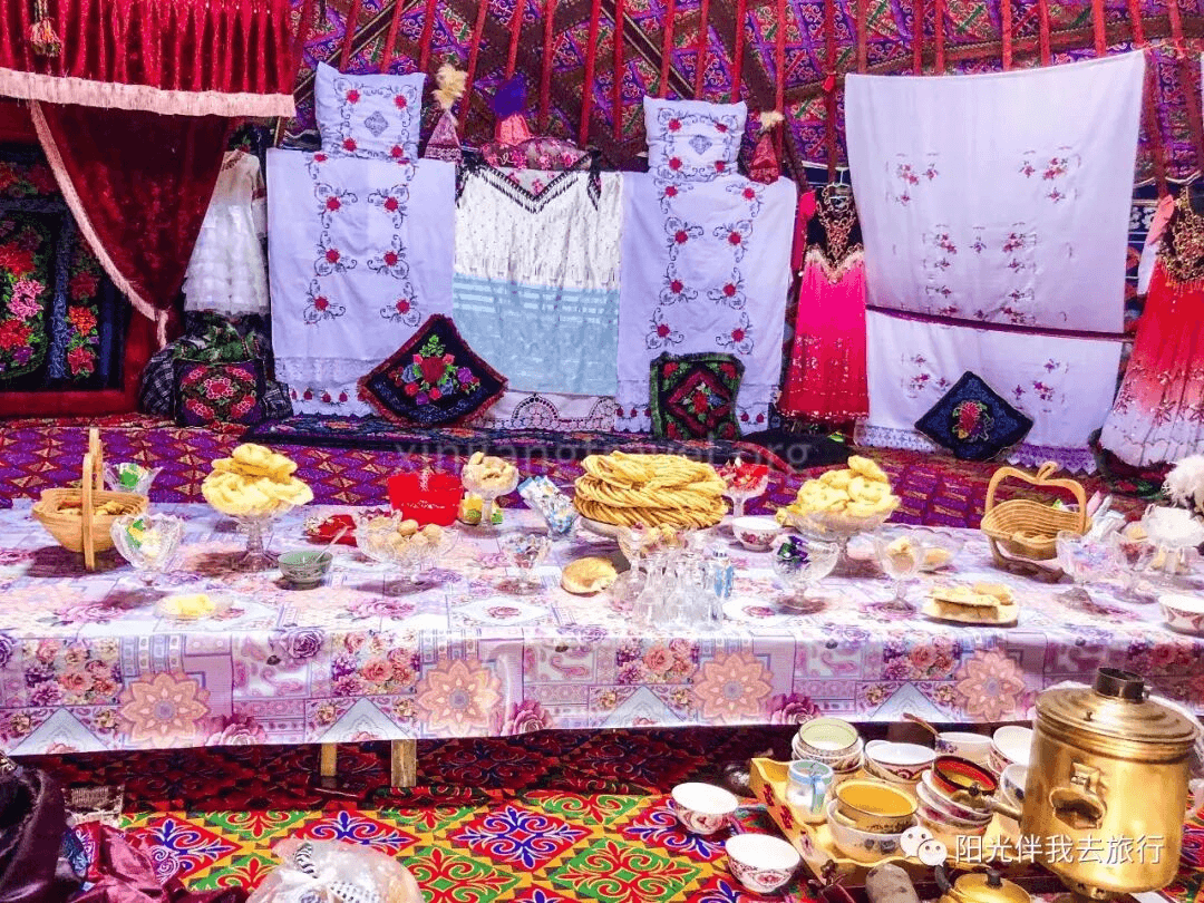
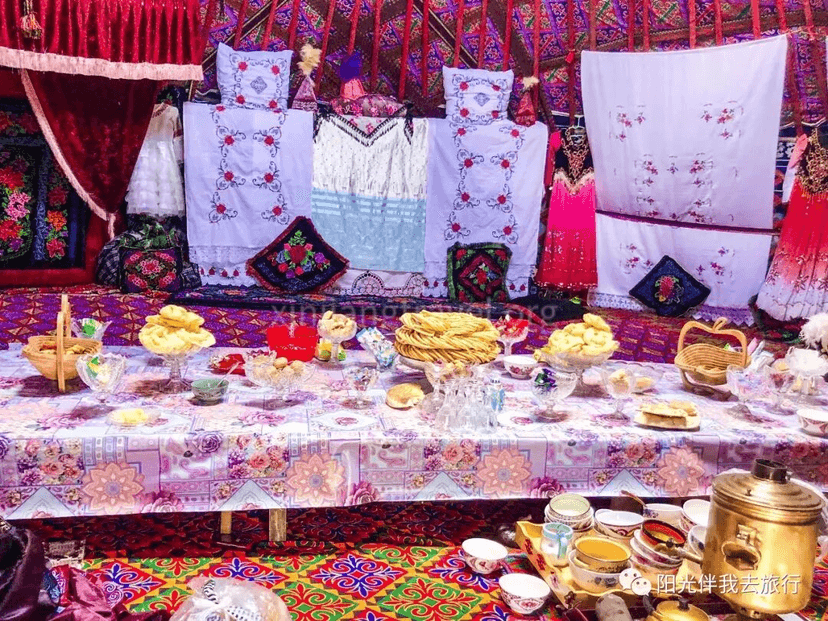
Scenic Area Center – The bus arrives at the center after driving several dozen kilometers. It is well-maintained, with Kazakh yurts nearby. The Kazakh people are warm and welcoming, inviting guests into their yurts. It happened to be the annual Corban Festival, and the beautiful yurts were filled with food.
Sky Grassland – From the center, you can take a tourist shuttle to one of three sightseeing lines. We chose Line 1 to the “Sky Grassland.” The shuttle takes you up and finally stops by a snow mountain valley. The scenery here of the snow mountain canyon and the surrounding “sky grassland” is spectacular.
After visiting the Sky Grassland, the tour of Nalati Grassland Scenic Area ends. Drive to Tekes County for an overnight stay.
Day 6: Kalajun Scenic Area
Kalajun Scenic Area is located in the Tianshan Mountains of northwest Xinjiang. The altitude is between 2,000-3,600 meters, and the area is over 1,000 square km. “Kalajun” means “wilderness on the ridge” in Kazakh. It has abundant rainfall, a cool climate, and fertile soil, making it very suitable for growing pasture grass. There are over a hundred kinds of high-quality forage. The area combines natural landscapes like forests, grasslands, snow mountains, glaciers, rivers, lakes, and canyons. It centrally showcases the full scope of Xinjiang’s Tianshan natural scenery. UN experts believe the Kalajun grassland is one of the few top-tier natural pastures in the world. June to September is the golden season for the Kalajun grassland. About 200,000 livestock move here to escape the heat and fatten up, creating a lively scene.
Kalajun is located on the ancient northern route of the Silk Road. It is also a cultural holy land that blends historical, cultural, and scientific value. Since the 7th century BC, ethnic groups like the Saka, Yuezhi, Wusun, Xiongnu, Turkic, Uyghur, and Mongols have lived here. It still retains rich historical and cultural heritage. The national historical and cultural village of Qiongkushtai still preserves the traditional Kazakh way of life and production.
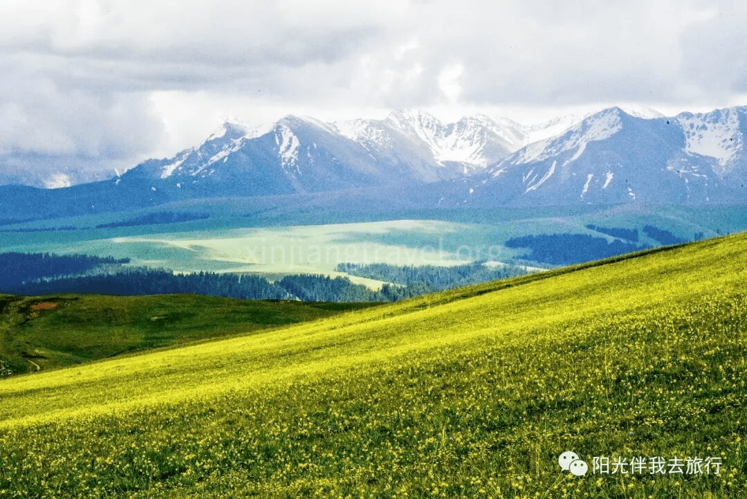
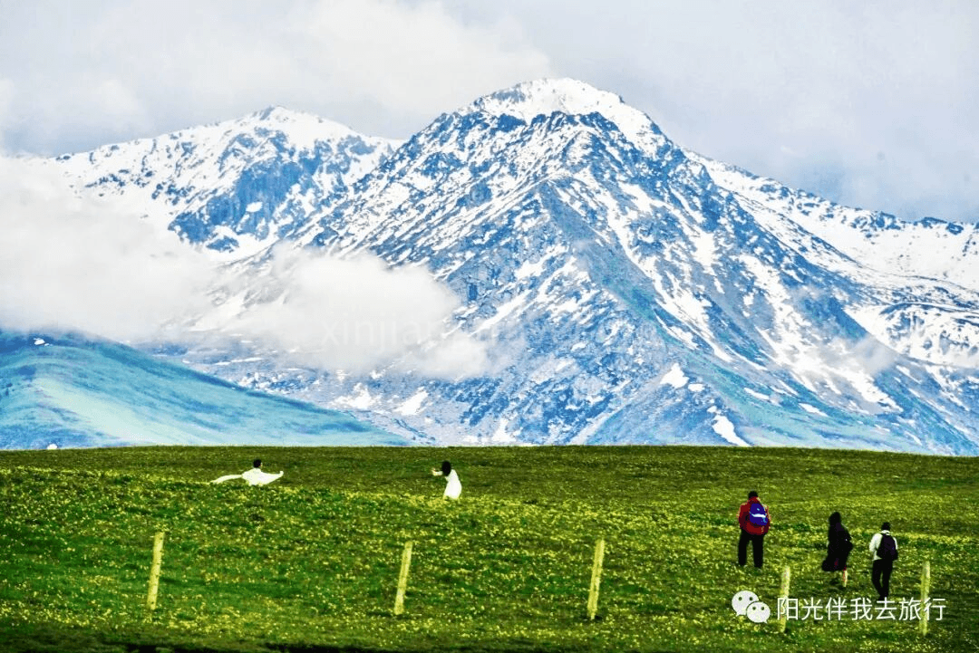
After visiting the Kalajun Scenic Area, drive 300 km to Zhaosu. Along the way, the rapeseed flowers are yellow, the hills are rolling, and the scenery is enchanting!
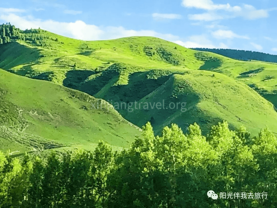
Stay overnight in Zhaosu.
Day 7: Xiatan Scenic Area
Early this morning, drive to the Xiatan Scenic Area. It is a tourist destination full of mystery. It is near the main range of the Tianshan Mountains, with the misty Tekes River. The Xiatan Canyon is the mountain pass of this river. The ancient trail, ruins, folk village, and natural landscapes here form a unique ancient cultural scenic area. “Xiatan” means “ladder” in Mongolian. Crossing the 3,600-meter main ridge of the Tianshan Mountains, it connects the north and south. It was an important ancient transportation route from Ili to Aksu, hence the name “Xiatan Ancient Trail.” Today, this trail has long been abandoned. Due to the complex terrain in the canyon, with high mountains, rushing water, and glaciers, crossing it is very dangerous and challenging. It has become a paradise for explorers, giving the route a more legendary quality.
The Tianshan Mountains and main peak, Tomur Peak, seen along the way – Upon leaving the hotel, the Tianshan range appears before you. The highest peak, Tomur, is clearly visible.
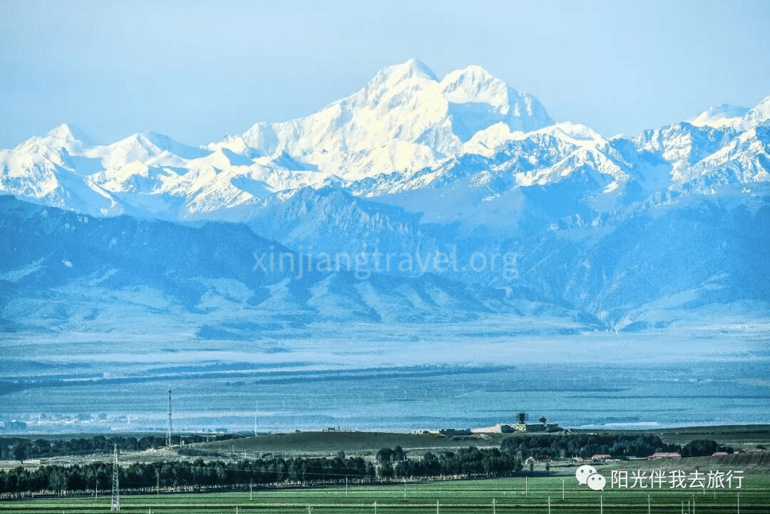
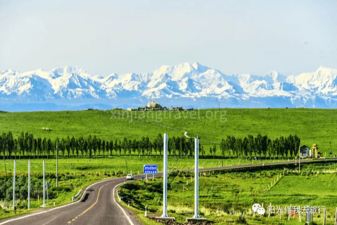
Xiatan Scenic Area Gate – After about a 1.5-hour drive, arrive at the gate. Here, you must get off and take the park’s shuttle bus into the area. The entrance area is also very pretty.
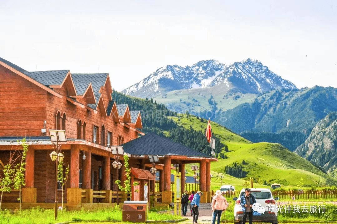
Scenery along the way in the park – As you enter, the scenery is pleasant. You also pass several named small scenic spots.
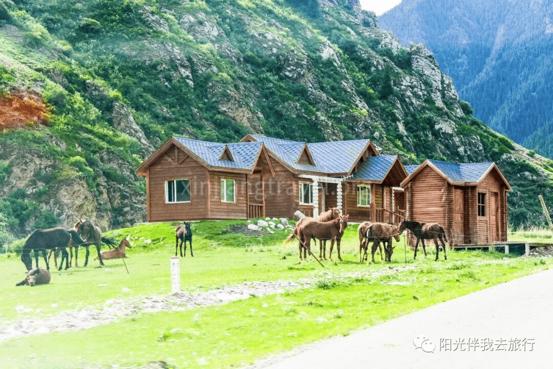
Scenery along the way in the park – As you enter, the scenery is pleasant. You also pass several named small scenic spots.
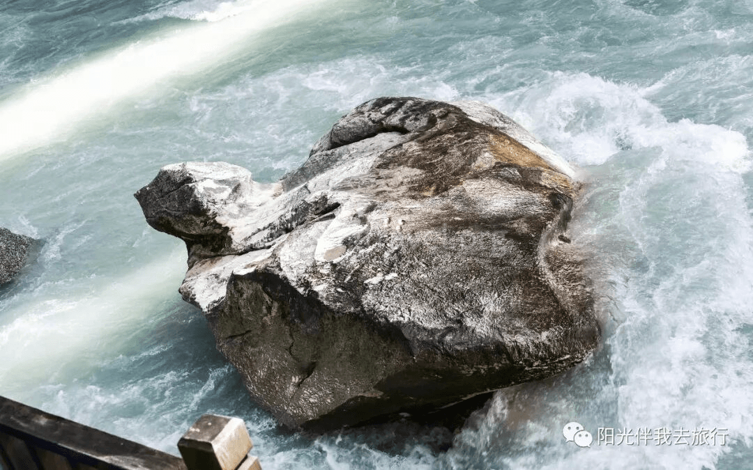
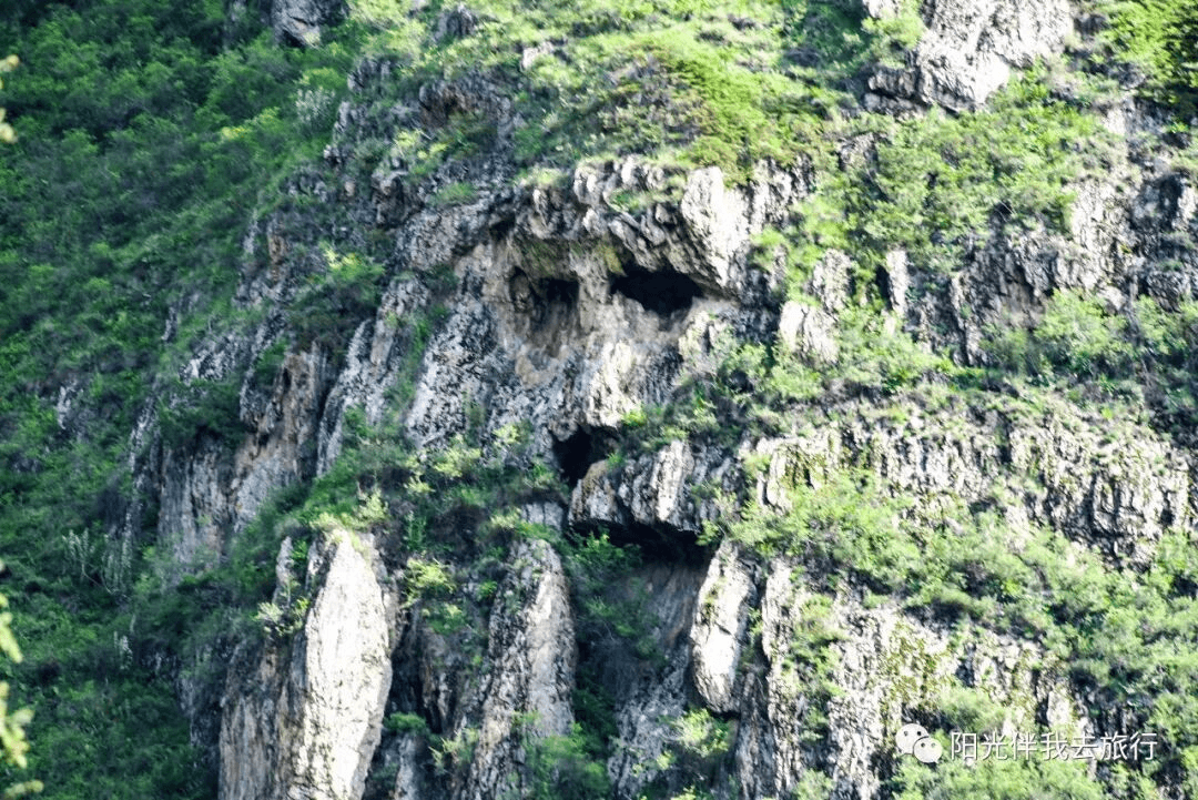
Old Man of Xiatan – This is a human face-shaped formation seen on the opposite mountain. They say it’s a face, but it looks more like a monkey’s face.
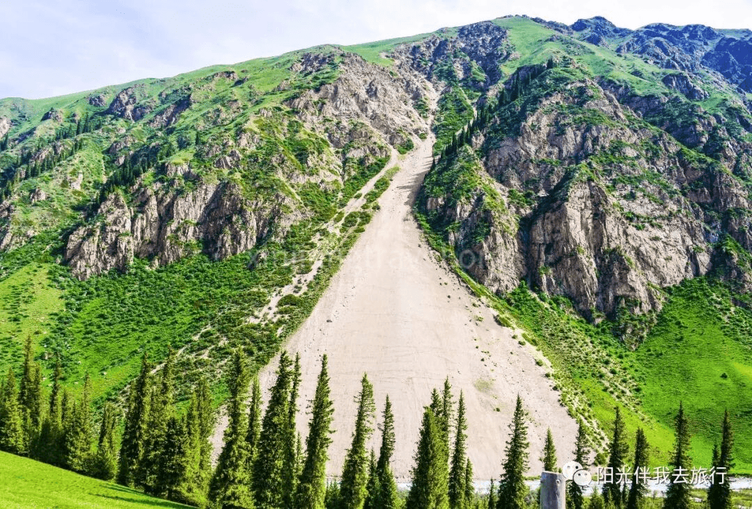
Quicksand Waterfall – It’s just a slope. On this side, there’s a patch of bare sand where nothing grows, looking just like a waterfall.
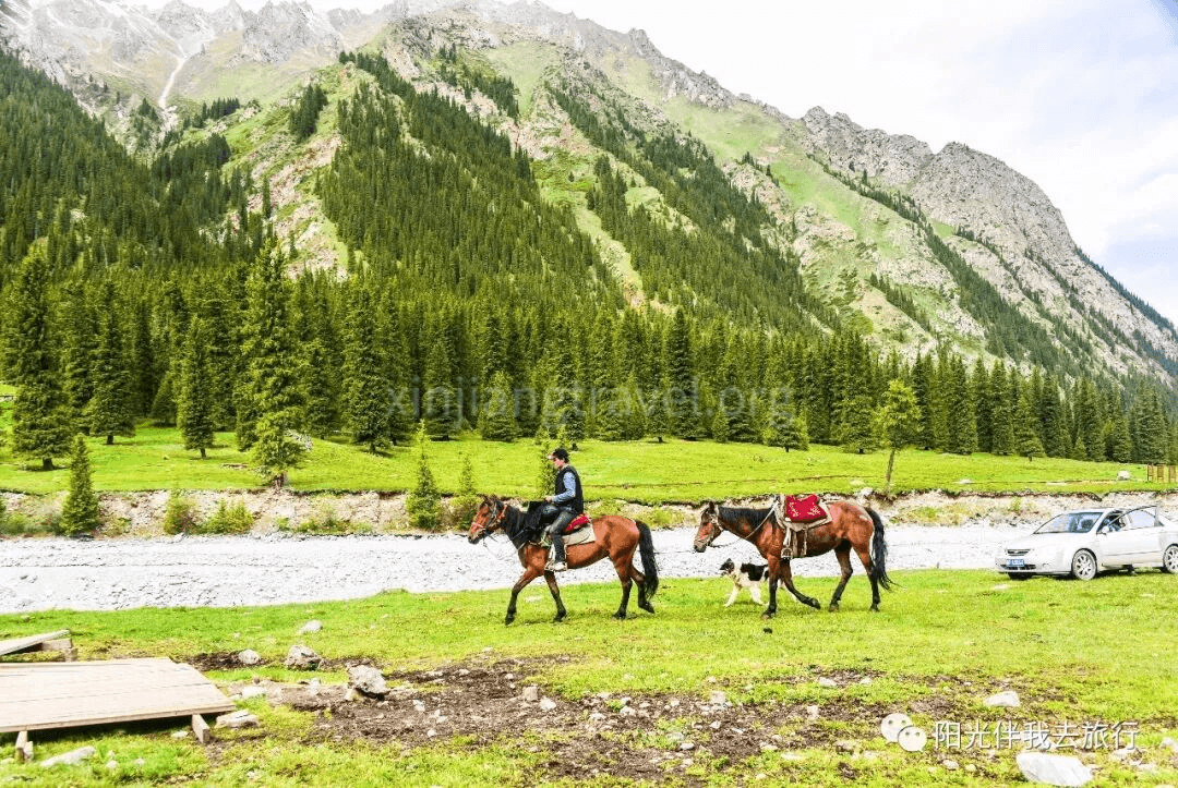
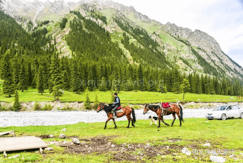
The further in you go, the scenery becomes more and more delicate. Finally, you arrive at the trailhead area of the Xiatan Ancient Trail. You see a well-built, wide dirt road leading into the distant mountains. People are strolling and sightseeing, either on foot or on horseback.
After playing here for 3 hours, drive 200 km to Yining for an overnight stay.
Day 8: Sayram Lake, Guozigou Valley
Sayram Lake is a national scenic area and one of Xinjiang’s top ten scenic spots. It is Xinjiang’s highest and largest alpine lake. It is the last place the warm, moist air currents from the Atlantic Ocean reach, hence the poetic name “The Last Teardrop of the Atlantic.” Historically known as “Jinghai” (Clean Sea), it sits at over 2,000 meters above sea level and covers 453 square km. The water is clear, with transparency up to 12 meters. Surrounded by mountains, it forms a closed alpine basin water system. A ring road around the lake has been built, with nine sightseeing points including the Commander’s Platform and a movie set.
Guozigou Valley is the natural gateway to the Ili region. It is a famous canyon pass that goes north to Sayram Lake and south to the Ili River Valley. In ancient times, it was the choke point of the new northern route of the Silk Road leading to Central Asia and Europe. It was called the “Iron Pass.” It is also praised as the “First Scenery of Ili” and a “Wondrous Fairyland” due to its pleasant scenery. The valley is 28 km long with steep terrain. When Genghis Khan went on his western expedition, he began to cut a path through the mountains and reportedly built 48 bridges. It remains an important section of the Urumqi-Ili highway.
From the overnight stay in Yining, you need to drive about 115 km to reach Guozigou Valley. Along the way, you see many beautiful lavender fields.
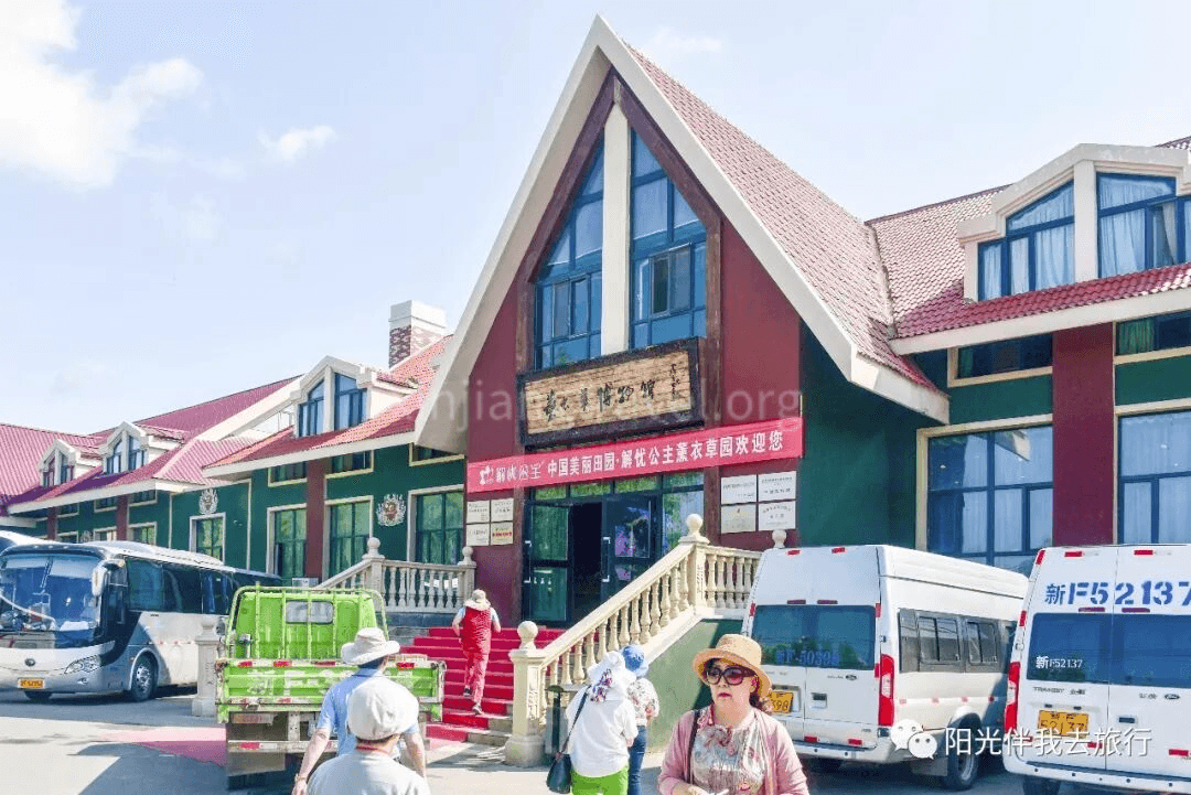
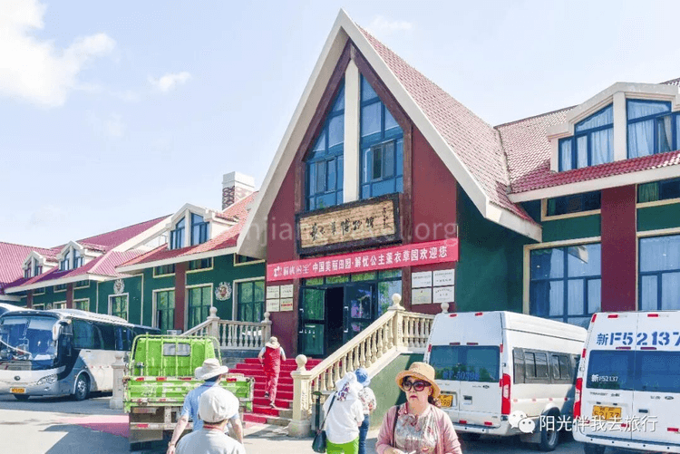
Princess Jieyou Lavender Garden – The Ili area is famous for its many lavender gardens. First, stop at a farm called “Princess Jieyou Lavender Garden” for a visit and take many nice photos.
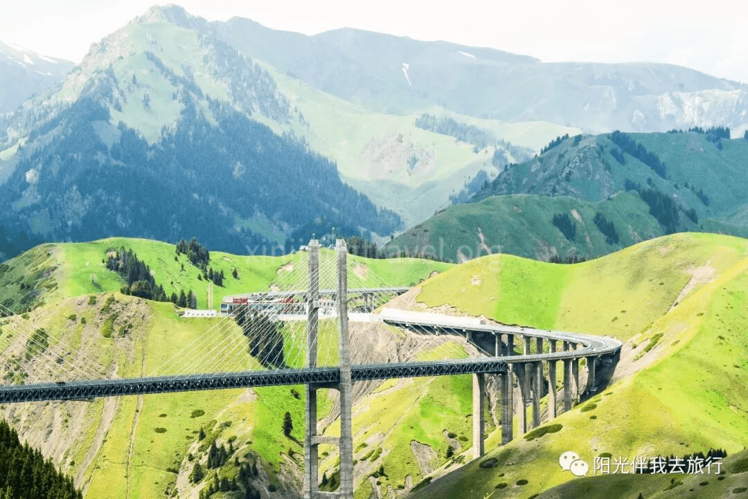
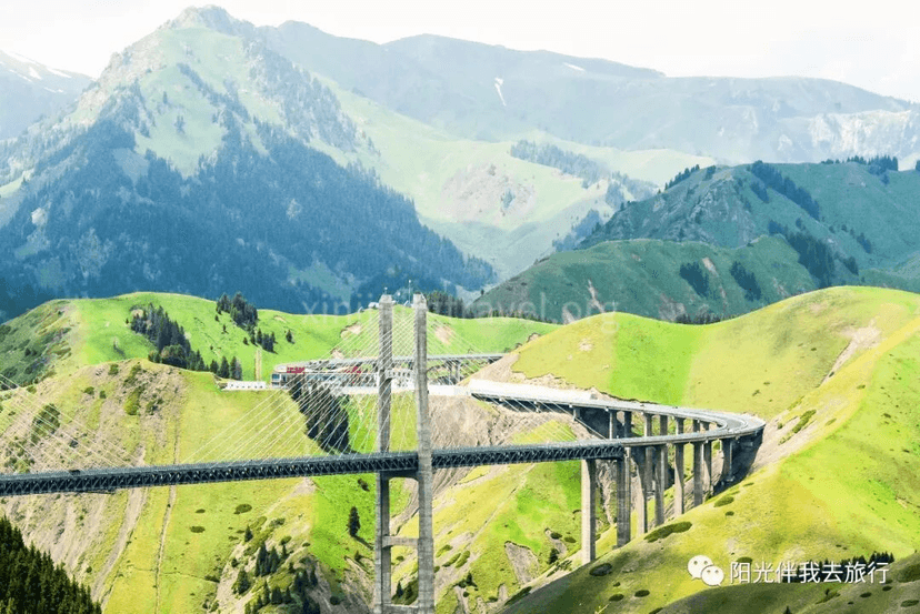
Guozigou Valley – Leaving the lavender garden, after over an hour, you enter Guozigou Valley. Suddenly, a magnificent bridge stands tall in the canyon. It’s awe-inspiring.
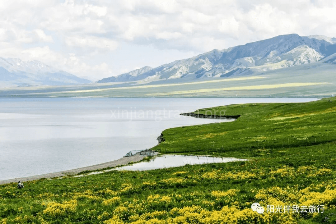
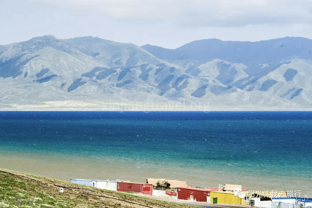
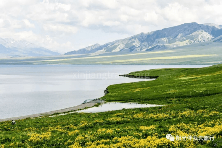
Sayram Lake – Exiting Guozigou Valley and driving another ten kilometers, you arrive at the Sayram Lake area. The moment you see the lake water, it’s a sudden, breathtakingly open view.
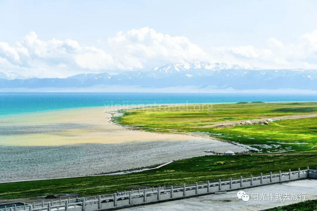
A ring road has been built along the shore of Sayram Lake, with several developed scenic spots. The most famous is the Commander’s Platform. Legend has it that Genghis Khan stationed 100,000 troops here and made a speech before his western expedition.
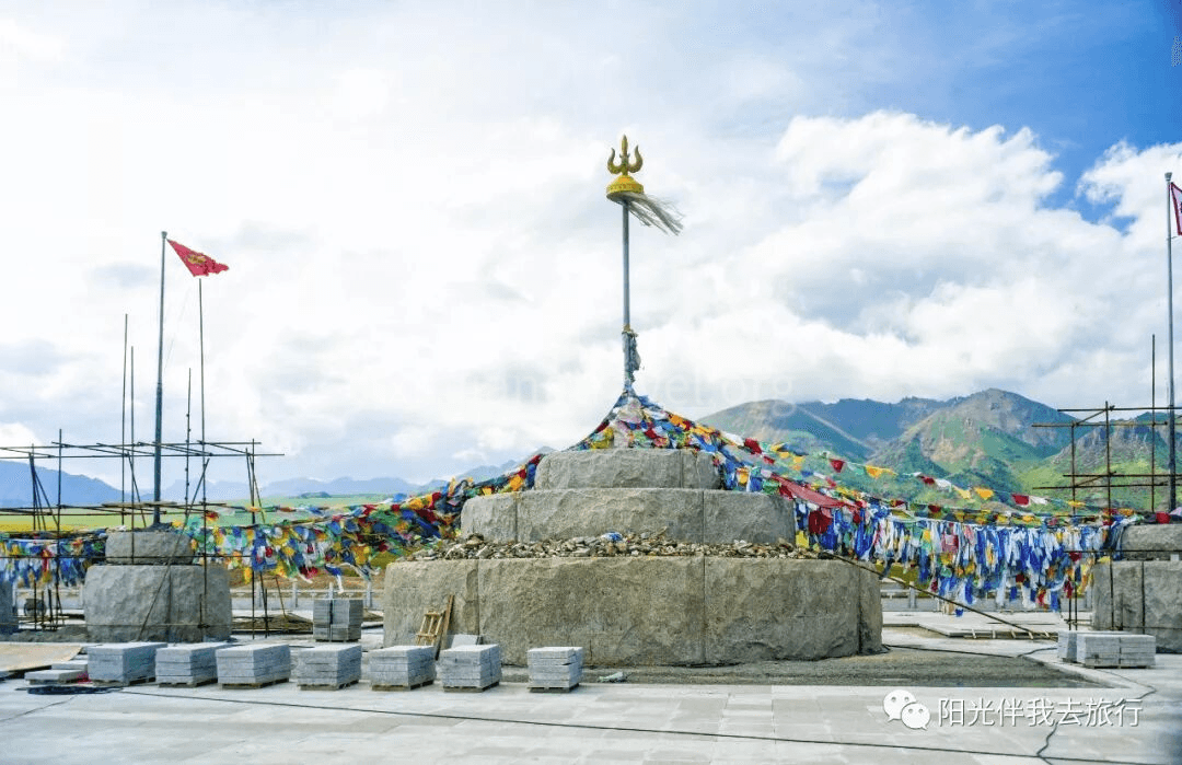
We came to an area called the “Maldives of Sayram Lake.” You could see the water change shades in layers, from light blue to deep blue. It was incredibly beautiful!
After finishing the tour of Sayram Lake, the bus drives about 320 km to Kuitun for an overnight stay.
At this point, the Northern Xinjiang tour is slowly coming to an end, but also reaching its climax. After leaving Burqin and traveling 180 kilometers, we arrived at one of the best scenic spots on this trip, Kanas. Kanas is a national 5A-level scenic area and ranks first among Xinjiang's top ten scenic spots. Kanas Lake has the shining title of "China's Most Beautiful Lake." It is the center of the Kanas tourist area. The lake is 24 kilometers long with an average width of 1.9 kilometers. The surrounding mountains are covered with virgin forests of larch, spruce, pine, and birch. The ground is lush with grass and wildflowers. Against a backdrop of blue sky and white clouds, the scenery is magnificent. The lake surface is a vast expanse of blue waves, with reflections of the peaks, and the colors are dreamlike and enchanting. Every autumn, the forests are painted in layers of color, and the lake and mountain scenery is breathtaking.
Scenery on the way to the scenic area -- Before even entering Kanas, the mountain road scenery started to become more and more beautiful, drawing exclamations of wonder from everyone
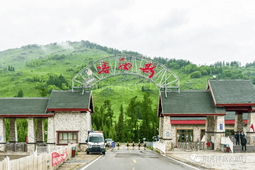
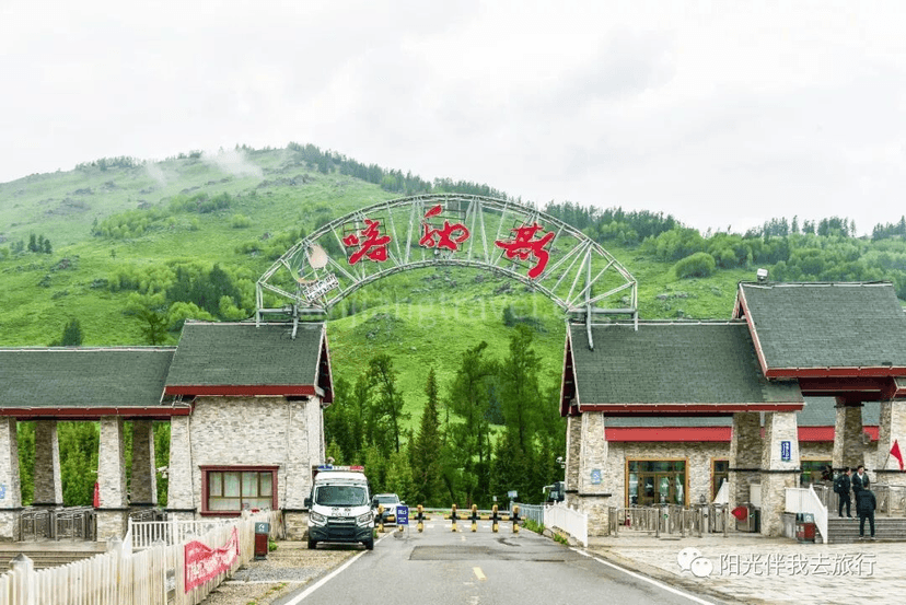
Scenic Area Gate
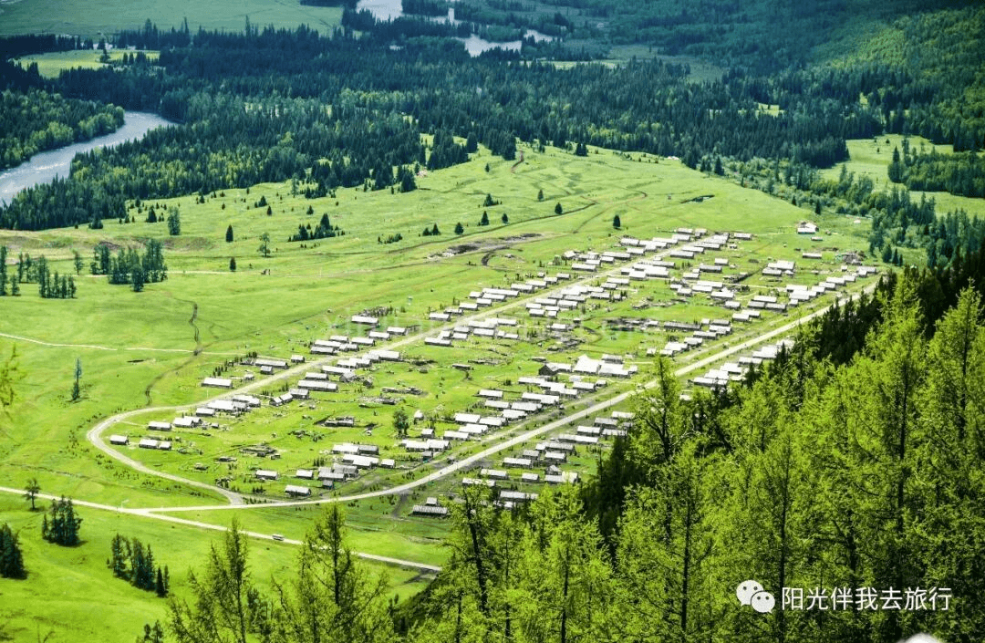
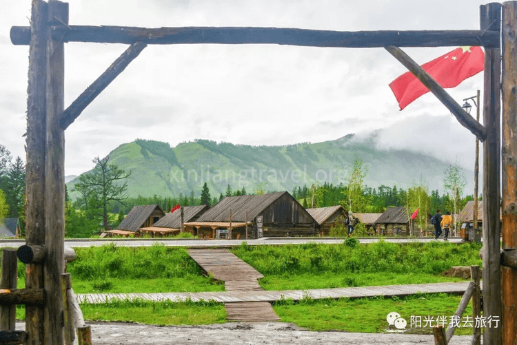
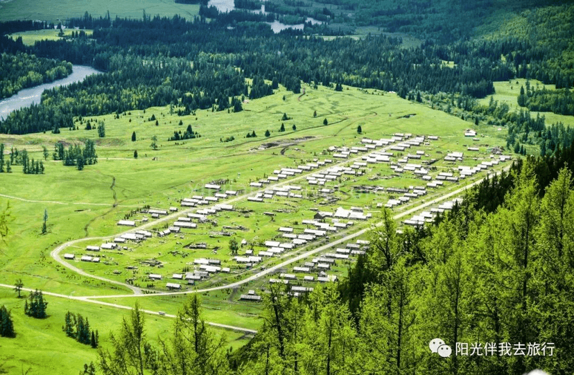
Tuva Village -- The Kanas Tuva Village is one of three Tuva villages in the area. It is located in the valley next to the bus center station. Surrounded by beautiful mountains and clear waters, it is home to about 2,000 Tuva people and has a long history, with records dating back to ancient documents.
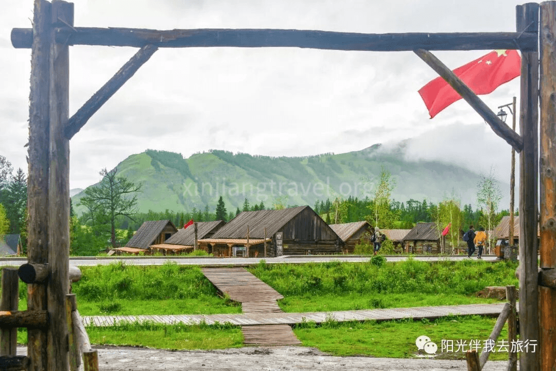
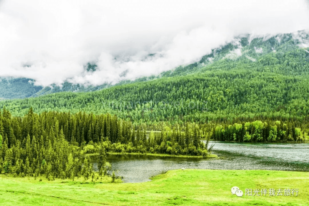
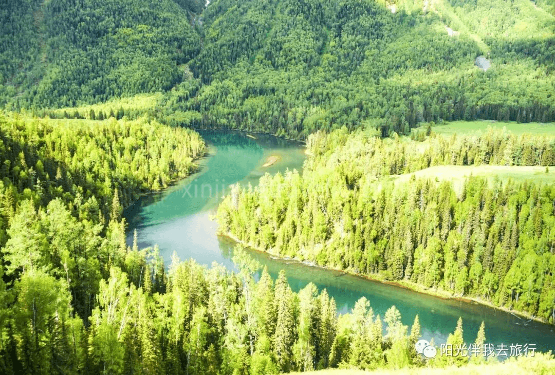
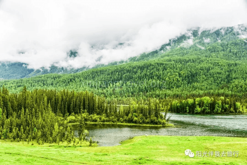
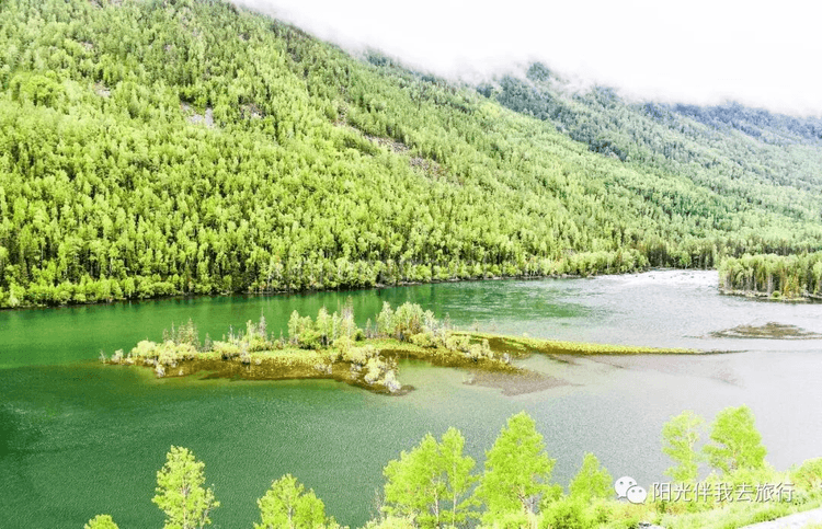
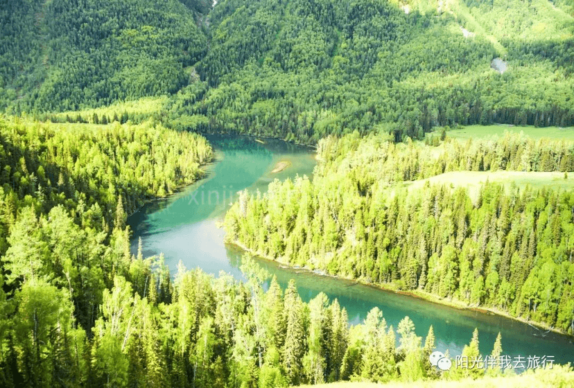
The Famous Three Bays -- One of the most famous attractions in the Kanas scenic area is the "Three Bays": Wolong Bay (Crouching Dragon Bay), Yueliang Bay (Moon Bay), and Shenxian Bay (Fairy Bay). Wolong Bay is the most lifelike; an islet in the river looks exactly like a little dragon, it's incredibly vivid! Yueliang Bay seems to be the most famous, and often has the most tourists. That crescent-shaped bend is indeed charming. In comparison, Shenxian Bay seems a bit of a stretch and doesn't quite live up to its name. The three bays are located on one side of the main road in the scenic area, about ten kilometers apart.

We stayed in the scenic area that night and continued to explore Kanas the next day.
This morning, we continued our tour of the Kanas scenic area, taking the scenic area bus to Guanyu Tai (Fish Watching Pavilion).
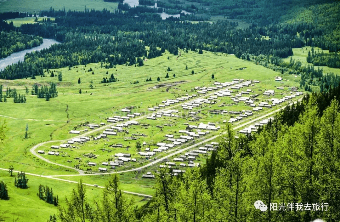
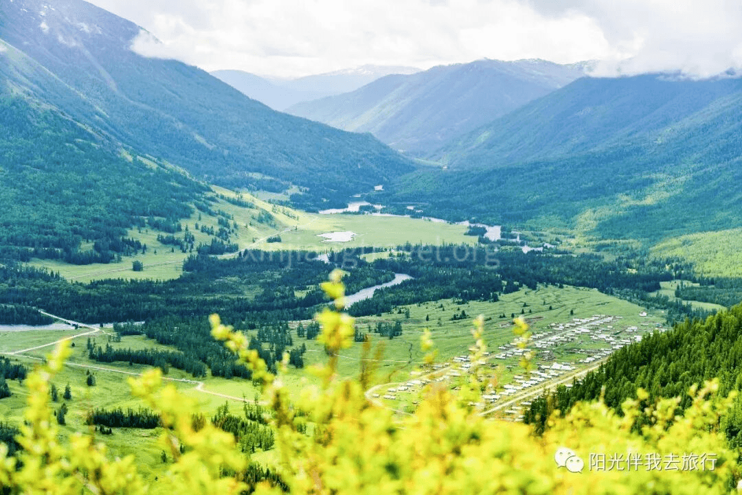
Guanyu Tai (Fish Watching Pavilion) -- This is a major attraction in the Kanas scenic area. It is an antique-style viewing pavilion built on a nearby mountaintop and is a great place to enjoy the panoramic view of Kanas Lake and its surroundings. You need to climb 1,046 steps to get there. From there, you can take in the beautiful mountains and waters, which is breathtaking! Here is the view seen while climbing the stairs:
Looking around from inside the pavilion, the beautiful scenery of Kanas Lake is fully in view.
After coming down from Guanyu Tai, the tour of the Kanas scenic area was over. We drove 70 kilometers to Hemu, passing through a surprising European-style small town called Jiadengyu along the way.
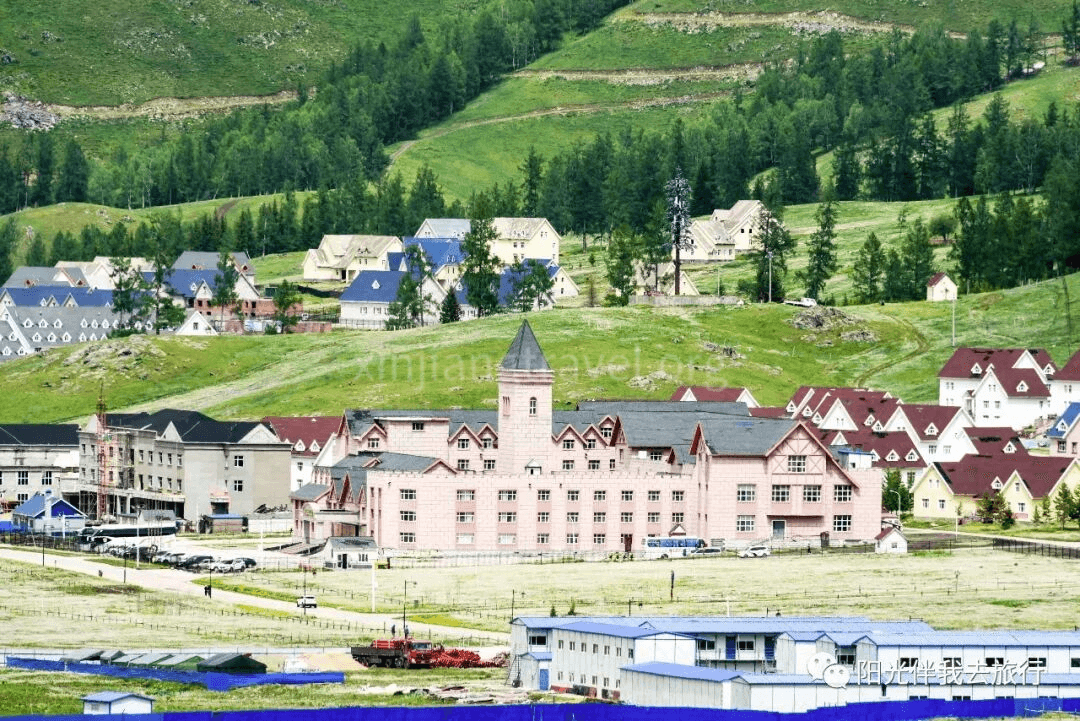
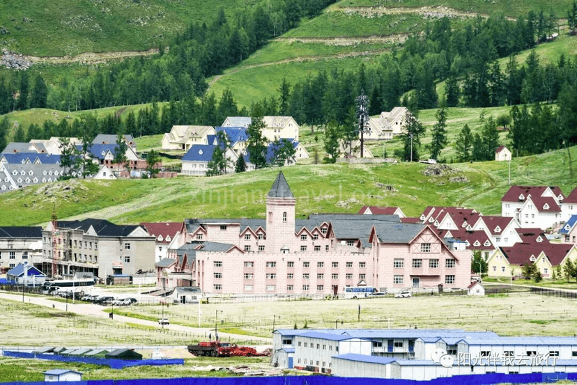
Jiadengyu -- Just 5 minutes after leaving the Kanas scenic area, we first arrived at Jiadengyu. The small town is located at the foot of a flat mountain between two other mountains. It has large European-style buildings with castles, looking just like a classic European mountain town. After seeing the primitive log cabins in the area, suddenly seeing these European-style buildings was a refreshing change! Jiadengyu is located between the two major scenic areas of Kanas Lake and Hemu and is the gateway and a must-pass location for both. It now has buildings in Russian, Japanese, and German styles, set among the dense forests of the Altai Mountains, becoming a unique风景线 (scenery). It is known as "China's Little Switzerland."
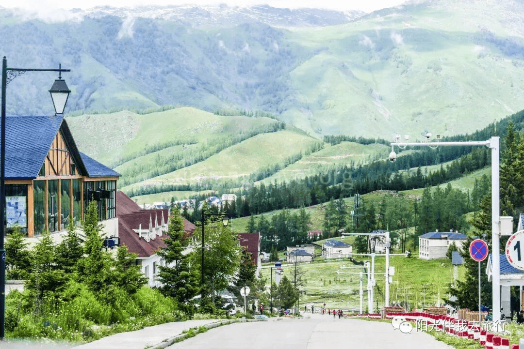
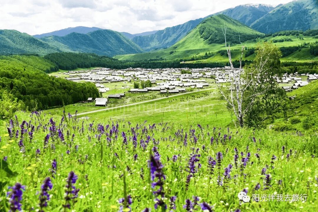
Introduction to Hemu Scenic Area -- The last major scenic area of the Xinjiang trip is the long-awaited Hemu scenic area. It is about 70 kilometers from Kanas and is a scenic area centered around the dreamlike and beautiful Hemu Village. It is part of the greater Kanas scenic area. Hemu Village is located in the northernmost part of Xinjiang, near the borders of Mongolia and Russia. Log cabins are scattered throughout the village, full of a primitive flavor, half-hidden among大片 (large areas of) birch forests. In the morning, clouds hang around the mountainsides, smoke begins to rise from the cabins, and sunlight falls on the birch forests. Cattle and sheep graze leisurely on the mountain pastures. The green grass in the foreground, the pine forests on the distant mountains, and the blue sky and white clouds on the mountaintops all come together to form an exquisite picture of nature, with colors so rich they are breathtaking. Hemu Village was named one of "China's Six Most Beautiful Ancient Towns and Villages" by Chinese National Geography. Known as a "Photographer's Paradise," it is called "God's Back Garden" by the locals.
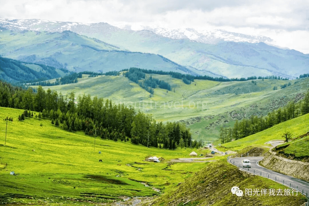
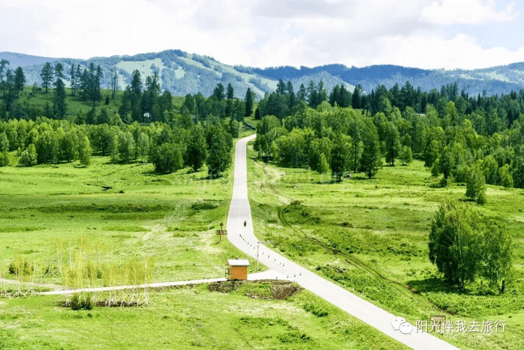
Hemu Grassland -- On the way to Hemu, we passed a large, breathtaking grassland, which is the Hemu Grassland. It is located in a mountain fault basin at an altitude of around 2,000 meters. The surrounding mountains are wide and thick, and the winding Hemu River runs through it, dividing the grassland in two. The mountain forests are dense and verdant, with a profusion of flowers and a rich fragrance. Cattle and sheep are everywhere, a charming and vast grassland scene. All the pictures here were snapped from the moving bus, showing the vastness and magnificence of the great grassland!
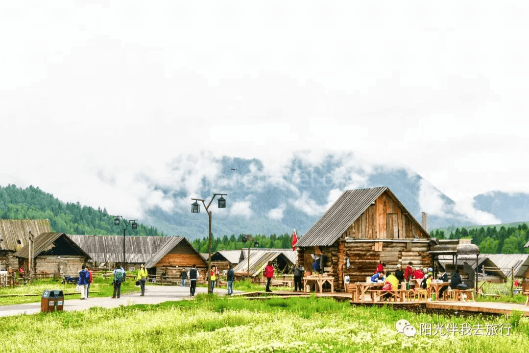
Hemu Mountain Villa Resort -- Not long after entering the Hemu scenic area is the large Hemu Mountain Villa resort. It is located in a valley, surrounded by glaciers, snow-capped mountains, virgin forests, and grasslands full of flowers. It is next to "one of China's six most beautiful ancient towns and villages," the Hemu Tuva Village. The hotel rooms are all made of logs, with an antique flavor, and are furnished with wooden furniture full of the local Tuva style, built to a 4-star standard. The Hemu Mountain Villa itself is an attraction full of Hemu charm.
We could stay here for the night.
Hemu Scenic Area Center -- This is also the center of Hemu Village. The rushing Hemu River flows through here, and a beautiful wooden pedestrian bridge spans it, becoming the gateway to the central scenic area of Hemu. After crossing the bridge is a well-maintained wooden boardwalk leading to the mountaintop viewing platform. It's not a difficult climb, and you can reach the top viewing platform in about half an hour after walking up four or five hundred steps. The viewing platform is actually a naturally formed alpine meadow. It is said that Genghis Khan once reviewed 100,000 troops here, so it is also called the "Dianjiang Tai" (Platform for Reviewing Troops). Standing on the viewing platform, you can overlook the entire Hemu Village, making it the best spot for taking panoramic photos of the village. Besides hiking, you can also ride a horse to the viewing platform.
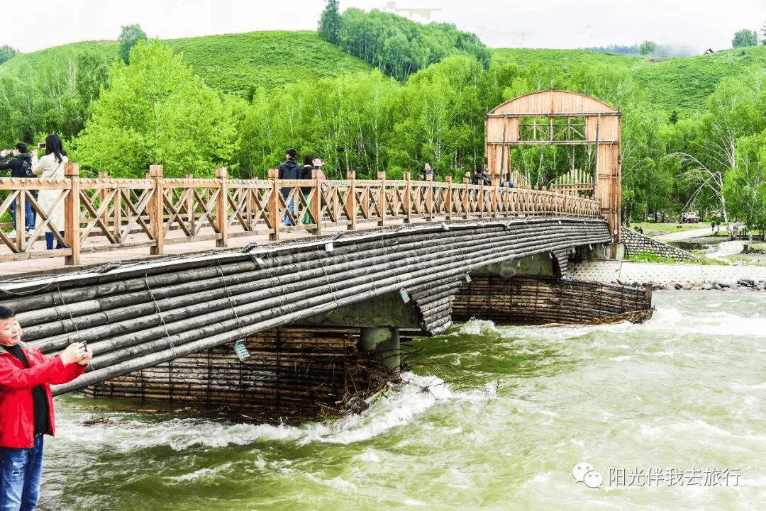
Mountaintop Platform of the Scenic Area -- After crossing the big wooden bridge, you are on the boardwalk to the mountaintop. This path is easy to walk, taking about half an hour to reach the top. The so-called mountaintop is actually a large, flat grassland where you can enjoy the surrounding scenery and see a panoramic view of Hemu Village in the distance. You can also ride a horse up and down the mountain, which is a choice for many tourists. Here is the view from the platform.
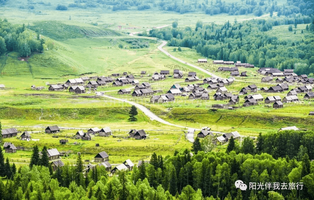
Dreamlike Scenery of Hemu Village -- Hemu Village is the farthest and largest of the three Tuva villages in Xinjiang (Hemu Village, Kanas Village, and Baihaba Village). All the houses in Hemu Village are built with logs, full of a primitive flavor. From the small hillsides around the village, you can look down on Hemu Village and see the misty bands of smoke rising from the chimneys. The scenery is dreamlike and more beautiful than a fairyland.
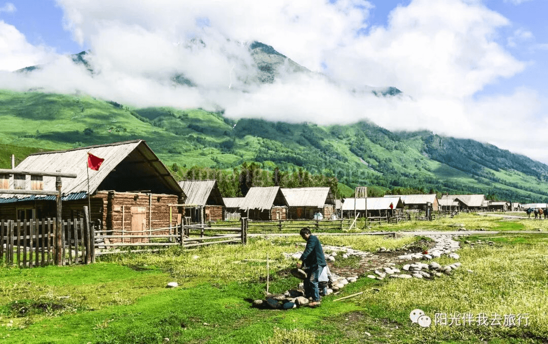
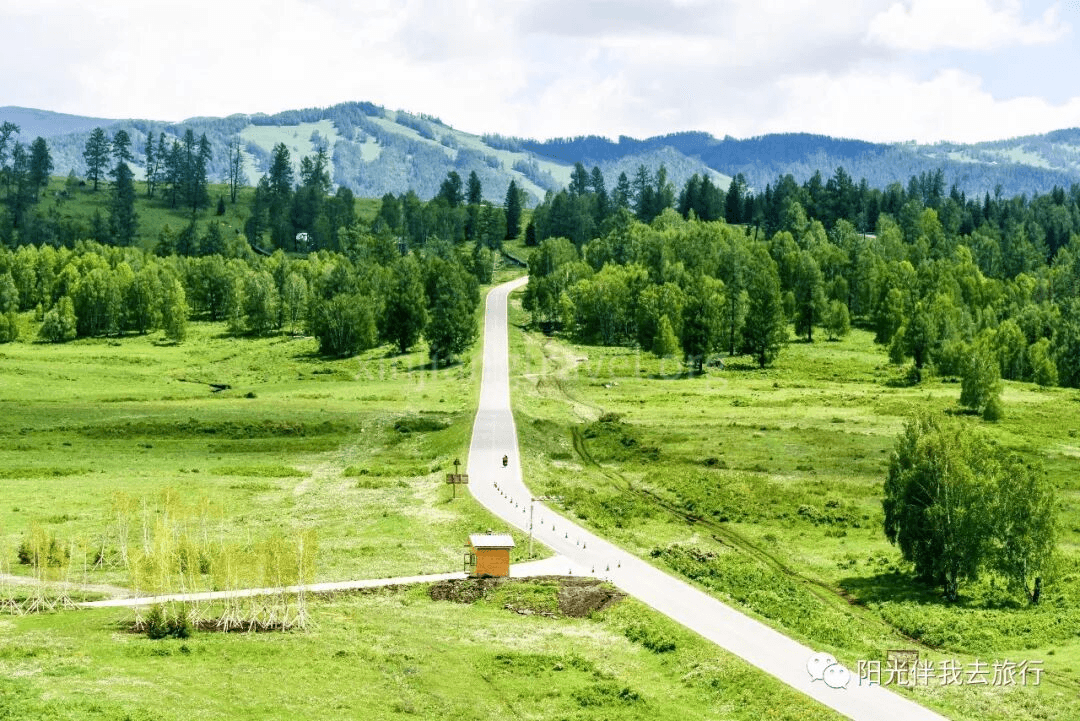
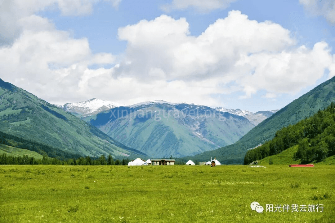
Here, the sightseeing tour of Hemu was over. We drove to the Kanas Airport and stayed at the Tianyuan Hotel at the airport.
We flew back to Urumqi from Kanas Airport early in the morning and arrived around noon. We then toured some of Urumqi's key attractions. The first was the Xinjiang Museum, the second was the Grand Bazaar, and the third was Hongshan Park. Here are some photos.
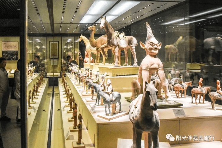
Xinjiang Museum -- Famous collections include the Loulan Beauty mummy.
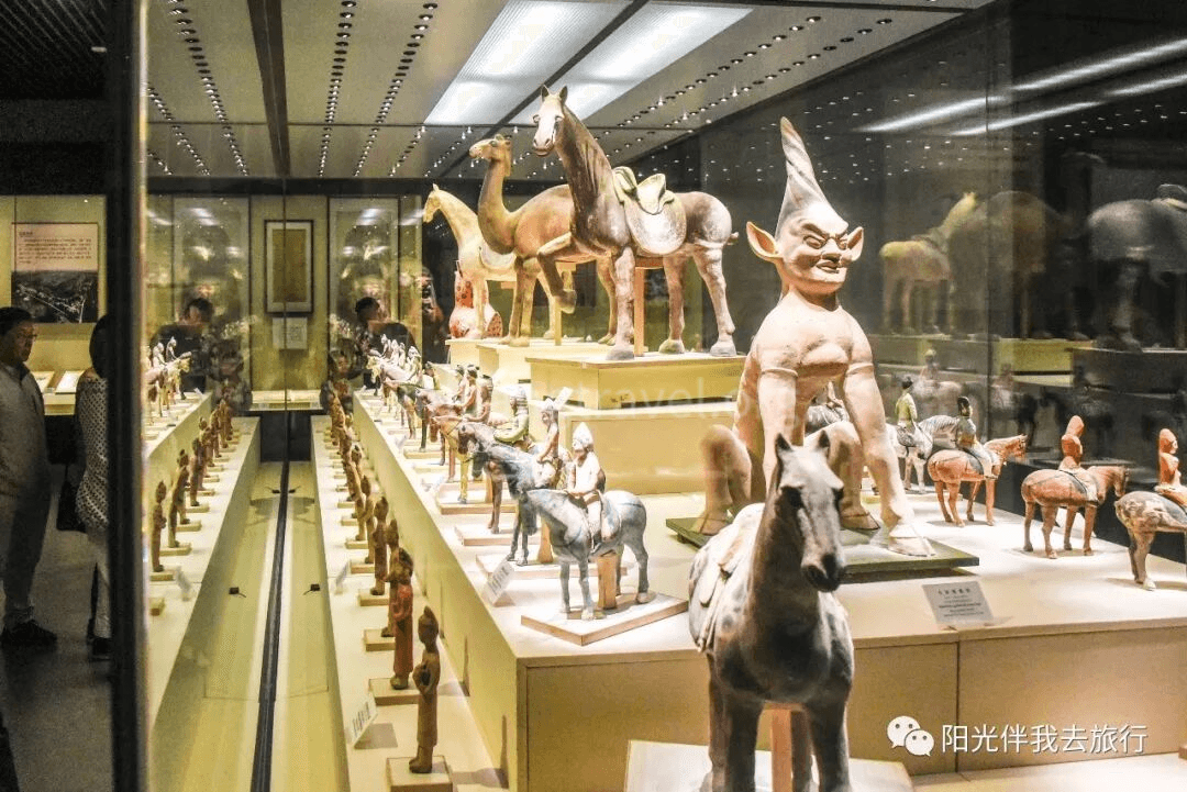
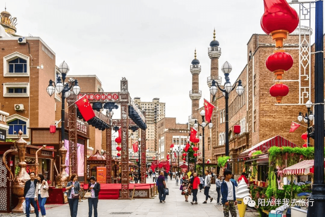
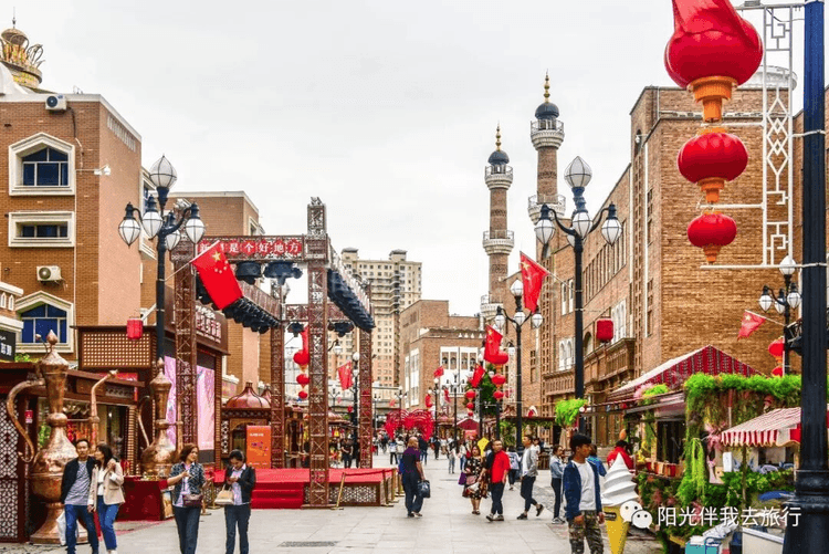
Grand Bazaar -- This is the largest bazaar in the world, integrating Islamic culture, architecture, ethnic commerce, entertainment, and dining. It is a gathering place and showcase for Xinjiang's tourism products and is known as the "Window of Xinjiang."
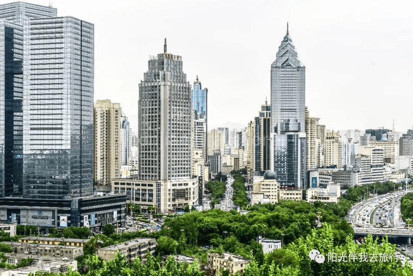
Hongshan Park -- Located in the center of Urumqi, Hongshan Park integrates tourism, classical features, cultural significance, and sports. It is a national 4A-level tourist attraction and one of the "New Ten Scenic Spots of Urumqi." From the top of the small hill, you can overlook the Urumqi city skyline. There is also a large temple inside, which is a popular spot for temple fairs.
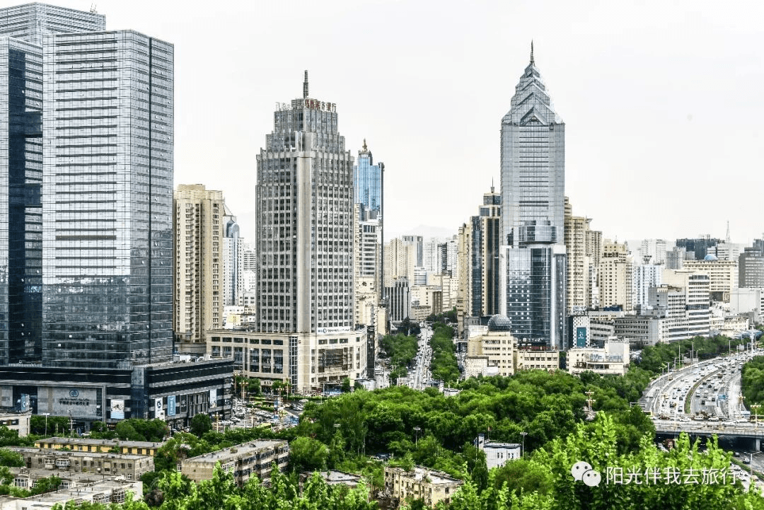
Watching "A Thousand Loops of the Western Regions" at the Xinjiang Grand Theatre -- If you have time in the evening, you can watch the iconic Xinjiang dance drama "A Thousand Loops of the Western Regions" at the Xinjiang Grand Theatre. The stage design of this drama is superb, integrating sound, light, color, and form. Using the entire theatre space as a stage for a three-dimensional performance, it allows you to experience the pinnacle of domestic stage play craftsmanship.
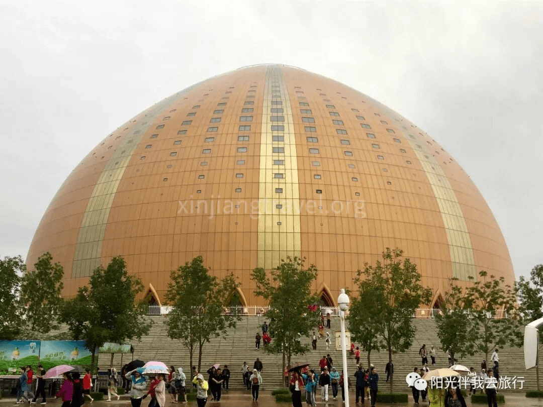

This concludes the 13-day comprehensive tour guide for Northern Xinjiang.
Original by: 阳光二哥
Brief Introduction to Northern Xinjiang’s Main Scenic Areas: Xinjiang is vast. The Tianshan Mountains generally form the dividing line between North and South Xinjiang. Influenced by warm, moist air currents from westerlies, the North is relatively wetter with more rain. This nurtures many natural landscapes like forests, grasslands, and lakes. The most famous are the Kanas Lake tourism area and the Ili Grasslands tourism area. Tourism here developed earlier, and facilities are relatively mature and complete. Planes, trains, and highways can reach the scenic spots directly. In comparison, many places in South Xinjiang need better transportation and tourism development. North Xinjiang means mountains and grasslands; South Xinjiang means deserts and Gobi. North Xinjiang means horses and songs; South Xinjiang means Muqam music and dance. The areas introduced here, except for Korla which is strictly in the South, all belong to the North. They cover almost all the famous scenic spots, hence the name “Northern Xinjiang Panoramic Grand Loop Tour.”
Important Notes for Foreigners Traveling in Xinjiang: Xinjiang’s stability needs are well known. Foreigners visiting should follow the rules. 1) In principle, foreigners can visit all scenic spots except Baihaba Village in Kanas. However, many places require a permit to enter. The rules for Bayinbuluke are especially strict. Foreign tourists must provide their itinerary, passport, and proof from a travel agency to the tourism bureau 3 months in advance. Then, they must take this approval to the foreign affairs bureau to get the permit. Without it, you will be turned back at the security checkpoint. So, foreigners basically cannot travel by self-drive. You must use a travel agency and plan far in advance, ideally six months or more. 2) During your trip, please do not ask about sensitive topics like ethnic policies or military matters. Do not casually comment on the country’s stability measures, and do not take photos of security facilities or personnel. Please be aware that public conversations may be recorded, and staff are required to report suspicious behavior. In short, focus on enjoying nature and avoid discussing other issues!
Is it Safe to Travel in Xinjiang? Generally speaking: Very safe! Xinjiang now has comprehensive security and stability facilities at all levels. The emergency response capability is faster and stronger than in the US, making major incidents extremely unlikely. Therefore, guides might jokingly tell you that Xinjiang is now the safest place in China!
Which Travel Agency to Use? It depends on the person. Simply put, for similar basic itineraries, the service level and cost for domestic vs. international agencies vary greatly. Take this 13-day tour as an example: many domestic groups quote 5,000–6,000 RMB, providing mostly 3-star service for dining, accommodation, and transport. The international group I recently joined, run by an agency for foreigners, cost over 12,000 RMB. It provided 5-star service throughout and was worth the money. So, please choose according to your needs.
Should You Tip? Generally, domestic groups don’t require or expect tips. However, international groups, especially those with Americans, often do, as they know tipping is standard on US tours. The amount varies, around $4–$6 per person per day total. A suggested ratio for the guide and driver is 6:4.
Best Time to Visit: Autumn is certainly the best. The leaves around Kanas change color, making the mountains colorful and incredibly beautiful. Spring is next best, with pleasant weather. The plains aren’t too hot yet, and the highland grasslands are green. Summer can be very hot in the plains, and winter sees heavy snow blocking the mountains.
Suggested Trip Duration: To see the main sights of Northern Xinjiang, 12–15 days is best. If time is short, there are many 3–7 day tour options available.
Cost Estimate (per person, excluding international airfare): This is closely related to the domestic vs. international agency mentioned earlier. A domestic group with 3-star service can be as low as 5,000–6,000 RMB per person. An international group with 5-star service can be 10,000–20,000 RMB, or even higher.
Travel Agency Recommendations: Here is one high-end and one mid-range option for reference only.
High-end: Xinjiang China International Travel Agency Co., Ltd. Address: Room 1802, No. 276 Guangming Road, Urumqi, Xinjiang. Tel: +86 13565834056 or 15699206236. Contact: Li Jing. Website: www.toursxinjiang.com or www.silkroadtravel.com
Note: Our recent 13-day trip was arranged by Lesley. It included 5-star hotels throughout, a luxury bus, good meals, and a top-notch guide. A perfect journey. The cost was about 12,500 RMB, including two flights within Xinjiang. Tips were extra. Everyone in our group of 18 gave it rave reviews and highly recommends Lesley’s company!
Mid-range: Retirement Club, 1st Floor, Building 3, No. 1436 Changning Road, Shanghai. Tel: 62260755, 62262567. The 12-day tour costs about 5,600 RMB for members. No tips.
Note: This information was obtained from regular retirees in Shanghai and is for reference only.
13-Day Itinerary Guide: Here is a classic Northern Xinjiang panoramic route, visiting the main scenic spots. This loop includes a flight at the beginning and end. Due to weather, the flight from Kanas in the north to Urumqi is closed in winter and opens around June 10th. If you start earlier, you can first fly to the southern city of Korla and travel northwards. If the northern flight is open, you can also fly to Kanas Airport first and travel southwards. Here is the route traveling from south to north.
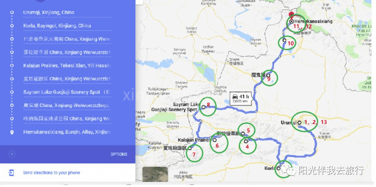
Day 1: Arrive in Urumqi.
Day 2: Visit Heavenly Lake (Tianchi).
Day 3: Fly to Korla early in the morning, sightsee there in the afternoon.
Day 4: Go to Bayinbuluke (350 km, 6 hours).
Day 5: Go to Nalati Grassland (150 km, 3 hours).
Day 6: Go to Kalajun Scenic Area (350 km, 6 hours).
Day 7: Go to Xiatan (200 km, 3 hours), then to Yining.
Day 8: Visit Sayram Lake and Guozigou Valley (450 km, 6 hours).
Day 9: Visit Ghost City (Devil City) and Five Color Beach (460 km, 6 hours).
Day 10: Go to Kanas (180 km, 4 hours).
Day 11: Kanas to Hemu (70 km, 2 hours).
Day 12: Hemu to Kanas Airport (80 km, 2.5 hours).
Day 13: Fly back to Urumqi, sightsee locally, end of trip.
Day 1: Fly to Urumqi
Fly to Urumqi today. The travel agency will pick you up from the airport and take you to the hotel. If you have time, you can go out and explore on your own.
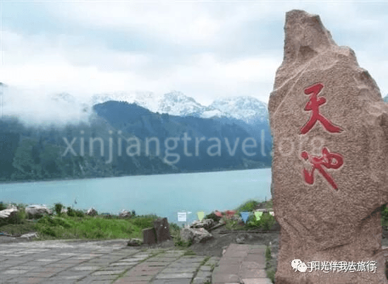
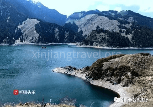
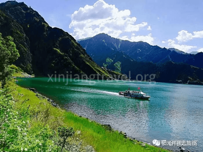
Day 2: One-Day Tour of Heavenly Lake (Tianchi)
Heavenly Lake is a national 5A-level scenic area, one of China’s top ten scenic spots, and a World Natural Heritage site. Historically known as “Yaochi” (Jade Pool), it is 97 km from Urumqi. The scenic area covers 548 square km. The lake surface is at an altitude of 1,910 meters. It is 3.5 km long from north to south and 0.8–1.5 km wide from east to west, with a maximum depth of 103 meters. The lake water is like a mirror, reflecting the snow-capped peaks. It is characterized by rich snow mountains, glaciers, alpine lakes, and surrounding spruce forests, forming a vertical natural landscape belt. It is one of the must-visit best scenic spots in Xinjiang.
Unfortunately, I haven’t had the chance to visit Heavenly Lake yet. Here is a one-day itinerary from Ctrip for reference:
08:30: Take a bus to the “Pearl of Tianshan” - Heavenly Lake Scenic Area.
10:00: Sightseeing at Heavenly Lake.
13:30: Lunch.
14:20: Continue sightseeing at Heavenly Lake.
16:50: Free time at Heavenly Lake (about 1 hour 40 minutes).
18:30: Return by bus (travel time about 1 hour 30 minutes).
20:00: End of the one-day tour.
Day 3: The City of Pears, Korla
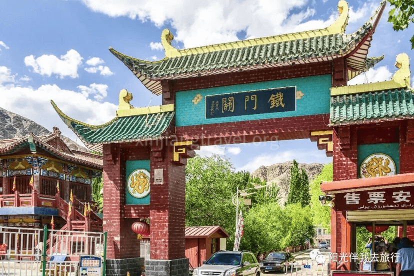
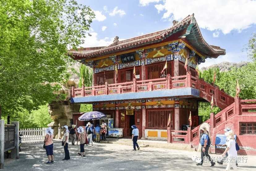
Early on the third day, fly to Korla, a major town in central Xinjiang, arriving around noon. Korla is the capital of the Bayingolin Mongol Autonomous Prefecture. It was a key stop on the ancient Silk Road and is a cradle of Western Region culture. It is an important transportation hub and distribution center for goods between North and South Xinjiang, as well as a political, economic, and cultural center. The famous fragrant pears are produced here, hence the name “City of Pears.” Korla itself doesn’t have many historical sites or natural scenery worth a special trip. However, it is a key transportation hub, so starting the loop tour from here is very convenient. The main scenic spots in Korla are the Iron Gate Pass and the Peacock River.
Iron Gate Pass – A major historical site in Korla. It was a perilous pass on the ancient Silk Road, a strategic choke point. A pass was established here during the Jin Dynasty, named Iron Gate Pass due to its steepness and solidity. Zhang Qian of the Western Han Dynasty passed here on his mission to the Western Regions, and Ban Chao also watered his horses at the Peacock River, which is why people also call it the “Horse-Watering River.”
Stay overnight in a Korla hotel.
Day 4: Bayinbuluke
“Bayinbuluke” means “abundant springs” in Mongolian. It is a high-mountain basin in the middle section of the Tianshan Mountains, surrounded by snow peaks. The altitude is about 2,500 meters, and the grassland covers 24,000 square km. It is China’s second-largest grassland after the Ordos in Inner Mongolia. The vast grassland is like a giant green carpet covering the earth, undulating and endless. Famous sights here include the “Nine Turns and Eighteen Bends” of the Kaidu River, famous for the sunset reflecting in the water and the colorful clouds. There is also the elegant Swan Lake and flocks of cattle and sheep all over the mountains. Every summer, flowers bloom on the grassland, and hundreds of thousands of cattle, sheep, horses, yaks, and camels graze on the green grass. The scene is spectacular.
The drive from Korla takes about 6 hours. After leaving the city, the landscape gradually changes to vast grasslands and snow mountains, becoming more and more beautiful. Suddenly, you’ll see the slogan “The People of Bayinbuluke Welcome You” on the grassy slopes!
Bayinbuluke Town – Entering the town, you’ll see colorful yurts of all kinds spread across the grass. It’s very picturesque.
Nine Turns and Eighteen Bends of the Kaidu River – The Kaidu River is one of Xinjiang’s major rivers, over 500 km long. It flows through the Bayinbuluke grassland, covering 22,000 square km. The source is shrouded in clouds. Especially in midsummer, it’s hard to tell where the clouds end and the water begins, as if the river falls from the sky. On the flat, vast grassland of the Little Yuldus Basin, the Kaidu River meanders, forming the spectacular “Nine Turns and Eighteen Bends.” The scenery changes with the seasons. From September to October, the sun sets directly on the central axis of the bends, reflecting nine suns in the water. This is the legendary “Nine Suns Linked Together” scene, truly spectacular. However, it’s very difficult to witness.
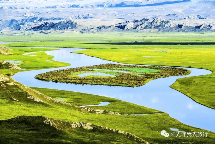
Swan Lake – Another spot on the Bayinbuluke grassland. It is said to be Asia’s largest and China’s only swan nature reserve, home to China’s largest population of wild swans. Every spring when flowers bloom, over 10,000 rare birds, including whooper swans, little swans, and mute swans, fly here from as far away as India, Myanmar, Pakistan, and even the Black Sea, Red Sea, and Mediterranean coasts to breed. When winter comes, they fly south over the Himalayas. So, seeing swans here depends on the season. If the time isn’t right, there won’t be many swans. For example, when I went in early June, I only saw a few swans lazily resting on the grass.
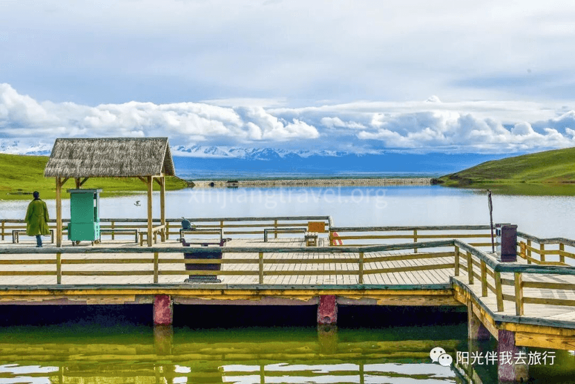
Instead, I saw a heavenly scene here – under the backdrop of distant snow mountains, large flocks of sheep were drinking and playing by the lake under the watch of their shepherds.
Stay overnight in a hotel in Bayinbuluke Town.
Day 5: Nalati Grassland
Nalati Grassland means “Green Valley” in Mongolian and “White Sun Slope” in Kazakh. It is located east of Nalati Town, Xinyuan County, Ili Prefecture. It is one of the world’s four major grasslands. It has been a famous pasture since ancient times. The beautiful grassland scenery combined with Kazakh folk customs makes it one of Xinjiang’s top ten scenic areas, a national 5A-level scenic spot, and a key brand scenic area.
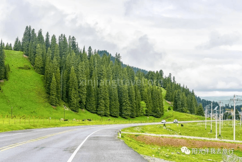
Along the way – It’s only 150 km from Bayinbuluke to Nalati, a 3-hour drive. The scenery is beautiful and pleasant. I also saw an “ovoo” (a stone heap used as a shrine or landmark) for the first time, though it didn’t look as romantic as in the song “Meeting at the Ovoo.”
Scenic Area Management Center – Arrive at the entrance of the Nalati Grassland. Here, you transfer to a scenic area bus. The scenery here is already quite charming.
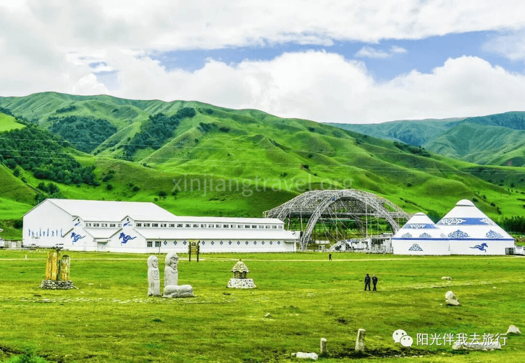
sland Scenery – The bus leaves the main gate and travels about 30 km to the scenic area center. It passes a section of winding mountain road with beautiful scenery on both sides. After entering the high mountain pasture, it becomes flat and incredibly open.
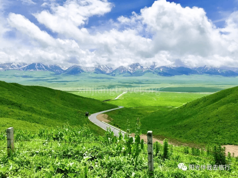
Scenic Area Center – The bus arrives at the center after driving several dozen kilometers. It is well-maintained, with Kazakh yurts nearby. The Kazakh people are warm and welcoming, inviting guests into their yurts. It happened to be the annual Corban Festival, and the beautiful yurts were filled with food.
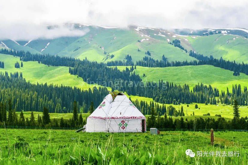
Sky Grassland – From the center, you can take a tourist shuttle to one of three sightseeing lines. We chose Line 1 to the “Sky Grassland.” The shuttle takes you up and finally stops by a snow mountain valley. The scenery here of the snow mountain canyon and the surrounding “sky grassland” is spectacular.
After visiting the Sky Grassland, the tour of Nalati Grassland Scenic Area ends. Drive to Tekes County for an overnight stay.
Day 6: Kalajun Scenic Area
Kalajun Scenic Area is located in the Tianshan Mountains of northwest Xinjiang. The altitude is between 2,000-3,600 meters, and the area is over 1,000 square km. “Kalajun” means “wilderness on the ridge” in Kazakh. It has abundant rainfall, a cool climate, and fertile soil, making it very suitable for growing pasture grass. There are over a hundred kinds of high-quality forage. The area combines natural landscapes like forests, grasslands, snow mountains, glaciers, rivers, lakes, and canyons. It centrally showcases the full scope of Xinjiang’s Tianshan natural scenery. UN experts believe the Kalajun grassland is one of the few top-tier natural pastures in the world. June to September is the golden season for the Kalajun grassland. About 200,000 livestock move here to escape the heat and fatten up, creating a lively scene.
Kalajun is located on the ancient northern route of the Silk Road. It is also a cultural holy land that blends historical, cultural, and scientific value. Since the 7th century BC, ethnic groups like the Saka, Yuezhi, Wusun, Xiongnu, Turkic, Uyghur, and Mongols have lived here. It still retains rich historical and cultural heritage. The national historical and cultural village of Qiongkushtai still preserves the traditional Kazakh way of life and production.
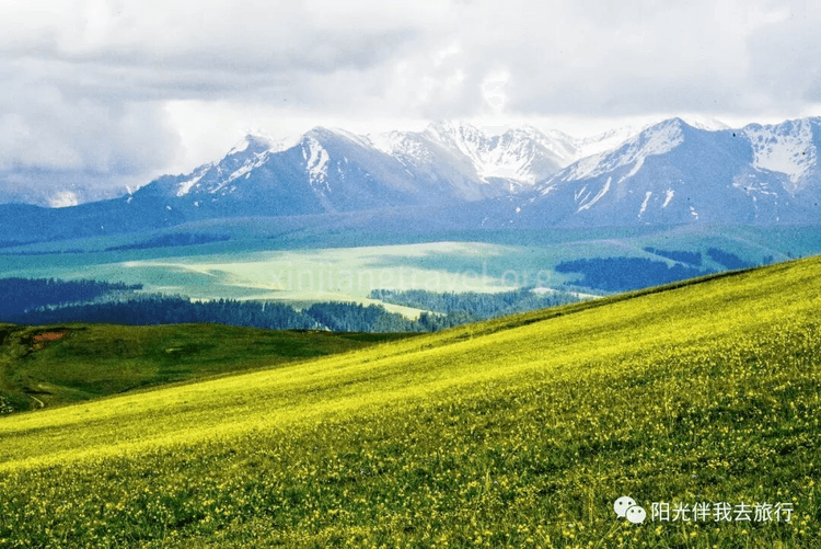
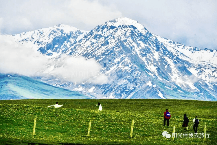
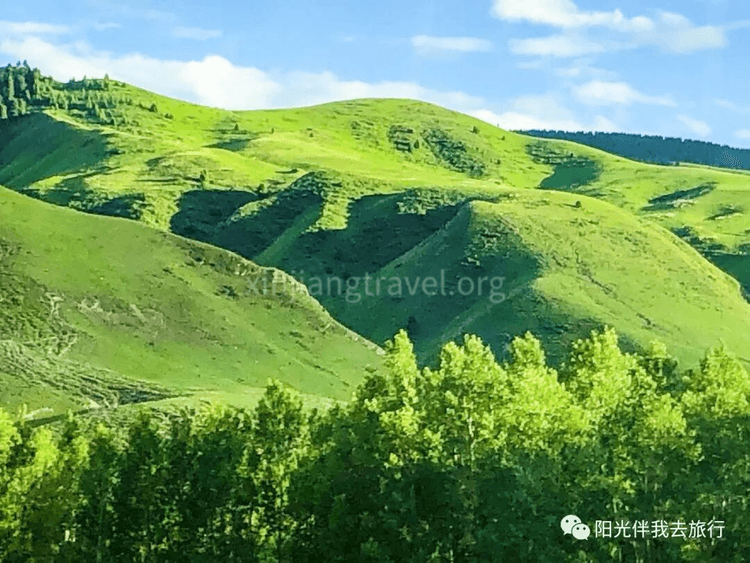
After visiting the Kalajun Scenic Area, drive 300 km to Zhaosu. Along the way, the rapeseed flowers are yellow, the hills are rolling, and the scenery is enchanting!
Stay overnight in Zhaosu.
Day 7: Xiatan Scenic Area
Early this morning, drive to the Xiatan Scenic Area. It is a tourist destination full of mystery. It is near the main range of the Tianshan Mountains, with the misty Tekes River. The Xiatan Canyon is the mountain pass of this river. The ancient trail, ruins, folk village, and natural landscapes here form a unique ancient cultural scenic area. “Xiatan” means “ladder” in Mongolian. Crossing the 3,600-meter main ridge of the Tianshan Mountains, it connects the north and south. It was an important ancient transportation route from Ili to Aksu, hence the name “Xiatan Ancient Trail.” Today, this trail has long been abandoned. Due to the complex terrain in the canyon, with high mountains, rushing water, and glaciers, crossing it is very dangerous and challenging. It has become a paradise for explorers, giving the route a more legendary quality.
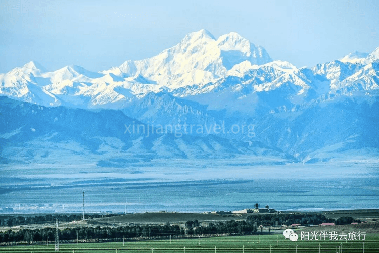
The Tianshan Mountains and main peak, Tomur Peak, seen along the way – Upon leaving the hotel, the Tianshan range appears before you. The highest peak, Tomur, is clearly visible.
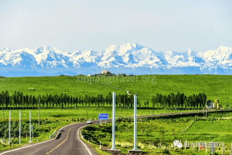
Xiatan Scenic Area Gate – After about a 1.5-hour drive, arrive at the gate. Here, you must get off and take the park’s shuttle bus into the area. The entrance area is also very pretty.
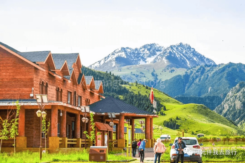
Scenery along the way in the park – As you enter, the scenery is pleasant. You also pass several named small scenic spots.
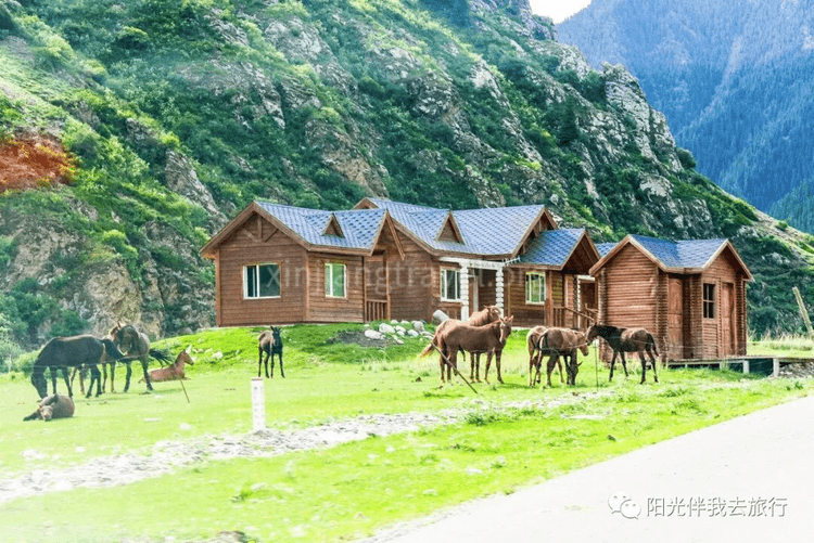
Scenery along the way in the park – As you enter, the scenery is pleasant. You also pass several named small scenic spots.
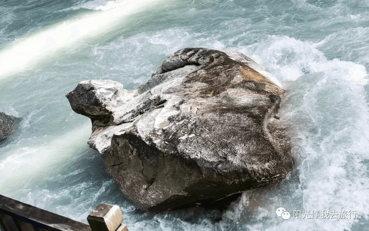
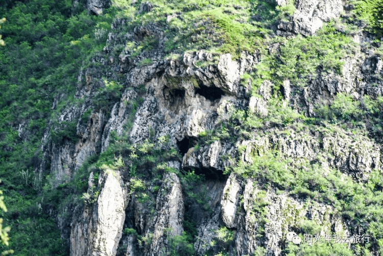
Old Man of Xiatan – This is a human face-shaped formation seen on the opposite mountain. They say it’s a face, but it looks more like a monkey’s face.
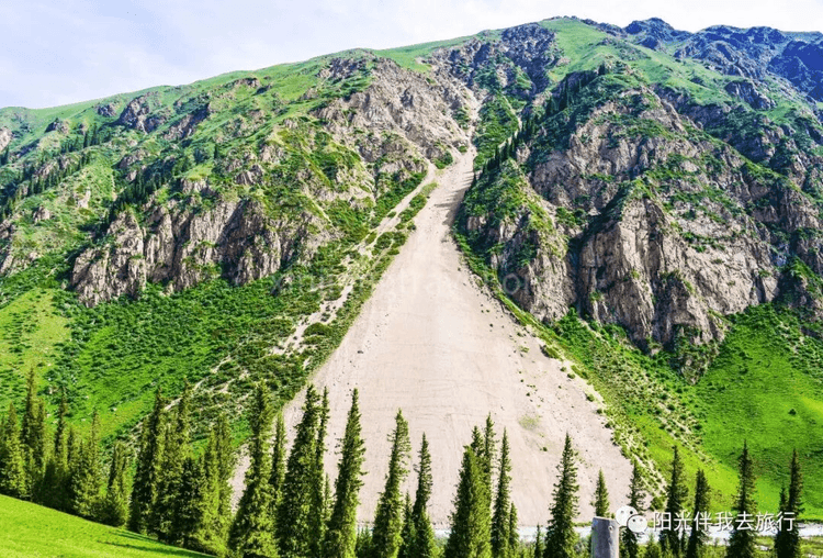
Quicksand Waterfall – It’s just a slope. On this side, there’s a patch of bare sand where nothing grows, looking just like a waterfall.
The further in you go, the scenery becomes more and more delicate. Finally, you arrive at the trailhead area of the Xiatan Ancient Trail. You see a well-built, wide dirt road leading into the distant mountains. People are strolling and sightseeing, either on foot or on horseback.
After playing here for 3 hours, drive 200 km to Yining for an overnight stay.
Day 8: Sayram Lake, Guozigou Valley
Sayram Lake is a national scenic area and one of Xinjiang’s top ten scenic spots. It is Xinjiang’s highest and largest alpine lake. It is the last place the warm, moist air currents from the Atlantic Ocean reach, hence the poetic name “The Last Teardrop of the Atlantic.” Historically known as “Jinghai” (Clean Sea), it sits at over 2,000 meters above sea level and covers 453 square km. The water is clear, with transparency up to 12 meters. Surrounded by mountains, it forms a closed alpine basin water system. A ring road around the lake has been built, with nine sightseeing points including the Commander’s Platform and a movie set.
Guozigou Valley is the natural gateway to the Ili region. It is a famous canyon pass that goes north to Sayram Lake and south to the Ili River Valley. In ancient times, it was the choke point of the new northern route of the Silk Road leading to Central Asia and Europe. It was called the “Iron Pass.” It is also praised as the “First Scenery of Ili” and a “Wondrous Fairyland” due to its pleasant scenery. The valley is 28 km long with steep terrain. When Genghis Khan went on his western expedition, he began to cut a path through the mountains and reportedly built 48 bridges. It remains an important section of the Urumqi-Ili highway.
From the overnight stay in Yining, you need to drive about 115 km to reach Guozigou Valley. Along the way, you see many beautiful lavender fields.
Princess Jieyou Lavender Garden – The Ili area is famous for its many lavender gardens. First, stop at a farm called “Princess Jieyou Lavender Garden” for a visit and take many nice photos.
Guozigou Valley – Leaving the lavender garden, after over an hour, you enter Guozigou Valley. Suddenly, a magnificent bridge stands tall in the canyon. It’s awe-inspiring.
Sayram Lake – Exiting Guozigou Valley and driving another ten kilometers, you arrive at the Sayram Lake area. The moment you see the lake water, it’s a sudden, breathtakingly open view.
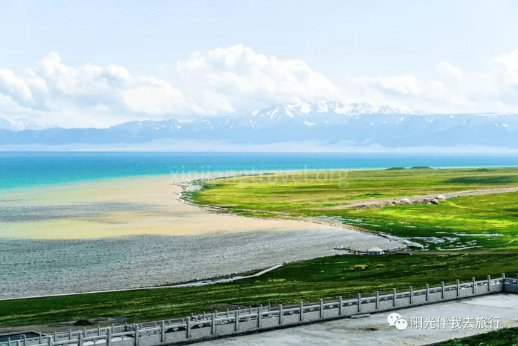
A ring road has been built along the shore of Sayram Lake, with several developed scenic spots. The most famous is the Commander’s Platform. Legend has it that Genghis Khan stationed 100,000 troops here and made a speech before his western expedition.
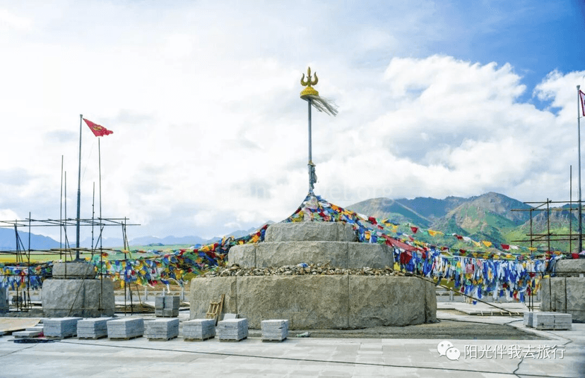
We came to an area called the “Maldives of Sayram Lake.” You could see the water change shades in layers, from light blue to deep blue. It was incredibly beautiful!
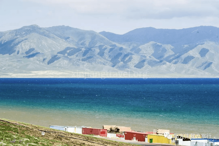
After finishing the tour of Sayram Lake, the bus drives about 320 km to Kuitun for an overnight stay.
At this point, the Northern Xinjiang tour is slowly coming to an end, but also reaching its climax. After leaving Burqin and traveling 180 kilometers, we arrived at one of the best scenic spots on this trip, Kanas. Kanas is a national 5A-level scenic area and ranks first among Xinjiang's top ten scenic spots. Kanas Lake has the shining title of "China's Most Beautiful Lake." It is the center of the Kanas tourist area. The lake is 24 kilometers long with an average width of 1.9 kilometers. The surrounding mountains are covered with virgin forests of larch, spruce, pine, and birch. The ground is lush with grass and wildflowers. Against a backdrop of blue sky and white clouds, the scenery is magnificent. The lake surface is a vast expanse of blue waves, with reflections of the peaks, and the colors are dreamlike and enchanting. Every autumn, the forests are painted in layers of color, and the lake and mountain scenery is breathtaking.
Scenery on the way to the scenic area -- Before even entering Kanas, the mountain road scenery started to become more and more beautiful, drawing exclamations of wonder from everyone
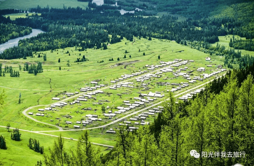
Scenic Area Gate
Tuva Village -- The Kanas Tuva Village is one of three Tuva villages in the area. It is located in the valley next to the bus center station. Surrounded by beautiful mountains and clear waters, it is home to about 2,000 Tuva people and has a long history, with records dating back to ancient documents.
The Famous Three Bays -- One of the most famous attractions in the Kanas scenic area is the "Three Bays": Wolong Bay (Crouching Dragon Bay), Yueliang Bay (Moon Bay), and Shenxian Bay (Fairy Bay). Wolong Bay is the most lifelike; an islet in the river looks exactly like a little dragon, it's incredibly vivid! Yueliang Bay seems to be the most famous, and often has the most tourists. That crescent-shaped bend is indeed charming. In comparison, Shenxian Bay seems a bit of a stretch and doesn't quite live up to its name. The three bays are located on one side of the main road in the scenic area, about ten kilometers apart.
We stayed in the scenic area that night and continued to explore Kanas the next day.
This morning, we continued our tour of the Kanas scenic area, taking the scenic area bus to Guanyu Tai (Fish Watching Pavilion).
Guanyu Tai (Fish Watching Pavilion) -- This is a major attraction in the Kanas scenic area. It is an antique-style viewing pavilion built on a nearby mountaintop and is a great place to enjoy the panoramic view of Kanas Lake and its surroundings. You need to climb 1,046 steps to get there. From there, you can take in the beautiful mountains and waters, which is breathtaking! Here is the view seen while climbing the stairs:
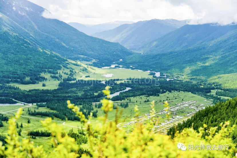
Looking around from inside the pavilion, the beautiful scenery of Kanas Lake is fully in view.
After coming down from Guanyu Tai, the tour of the Kanas scenic area was over. We drove 70 kilometers to Hemu, passing through a surprising European-style small town called Jiadengyu along the way.
Jiadengyu -- Just 5 minutes after leaving the Kanas scenic area, we first arrived at Jiadengyu. The small town is located at the foot of a flat mountain between two other mountains. It has large European-style buildings with castles, looking just like a classic European mountain town. After seeing the primitive log cabins in the area, suddenly seeing these European-style buildings was a refreshing change! Jiadengyu is located between the two major scenic areas of Kanas Lake and Hemu and is the gateway and a must-pass location for both. It now has buildings in Russian, Japanese, and German styles, set among the dense forests of the Altai Mountains, becoming a unique风景线 (scenery). It is known as "China's Little Switzerland."
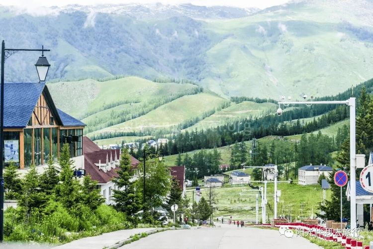
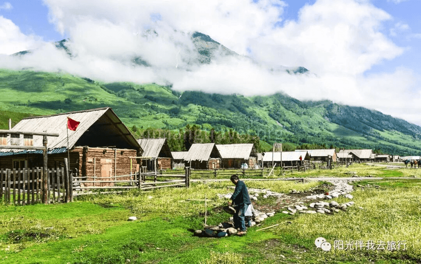
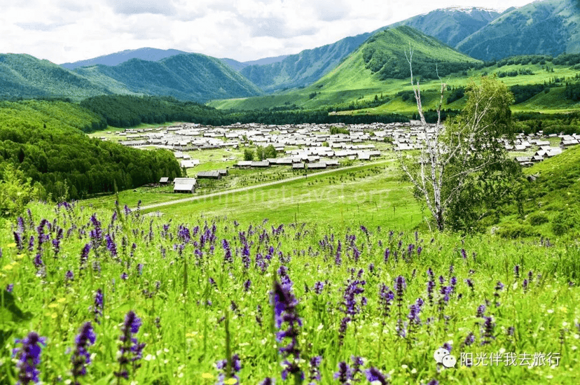
Introduction to Hemu Scenic Area -- The last major scenic area of the Xinjiang trip is the long-awaited Hemu scenic area. It is about 70 kilometers from Kanas and is a scenic area centered around the dreamlike and beautiful Hemu Village. It is part of the greater Kanas scenic area. Hemu Village is located in the northernmost part of Xinjiang, near the borders of Mongolia and Russia. Log cabins are scattered throughout the village, full of a primitive flavor, half-hidden among大片 (large areas of) birch forests. In the morning, clouds hang around the mountainsides, smoke begins to rise from the cabins, and sunlight falls on the birch forests. Cattle and sheep graze leisurely on the mountain pastures. The green grass in the foreground, the pine forests on the distant mountains, and the blue sky and white clouds on the mountaintops all come together to form an exquisite picture of nature, with colors so rich they are breathtaking. Hemu Village was named one of "China's Six Most Beautiful Ancient Towns and Villages" by Chinese National Geography. Known as a "Photographer's Paradise," it is called "God's Back Garden" by the locals.
Hemu Grassland -- On the way to Hemu, we passed a large, breathtaking grassland, which is the Hemu Grassland. It is located in a mountain fault basin at an altitude of around 2,000 meters. The surrounding mountains are wide and thick, and the winding Hemu River runs through it, dividing the grassland in two. The mountain forests are dense and verdant, with a profusion of flowers and a rich fragrance. Cattle and sheep are everywhere, a charming and vast grassland scene. All the pictures here were snapped from the moving bus, showing the vastness and magnificence of the great grassland!
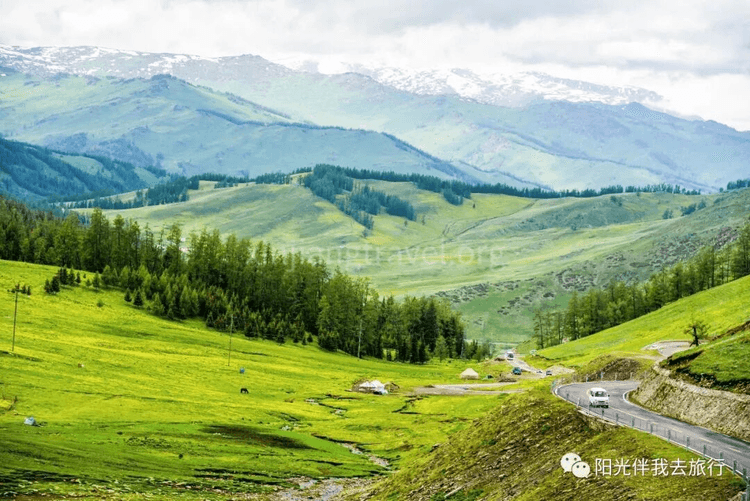
Hemu Mountain Villa Resort -- Not long after entering the Hemu scenic area is the large Hemu Mountain Villa resort. It is located in a valley, surrounded by glaciers, snow-capped mountains, virgin forests, and grasslands full of flowers. It is next to "one of China's six most beautiful ancient towns and villages," the Hemu Tuva Village. The hotel rooms are all made of logs, with an antique flavor, and are furnished with wooden furniture full of the local Tuva style, built to a 4-star standard. The Hemu Mountain Villa itself is an attraction full of Hemu charm.
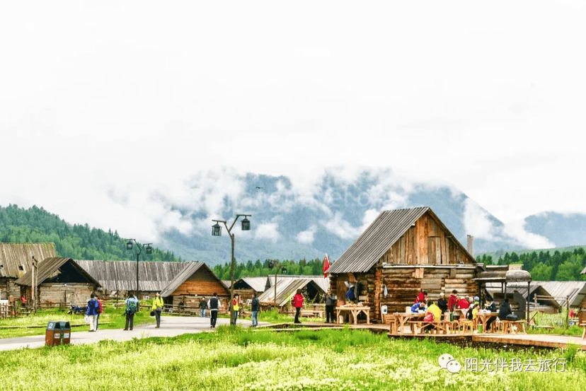
We could stay here for the night.
Hemu Scenic Area Center -- This is also the center of Hemu Village. The rushing Hemu River flows through here, and a beautiful wooden pedestrian bridge spans it, becoming the gateway to the central scenic area of Hemu. After crossing the bridge is a well-maintained wooden boardwalk leading to the mountaintop viewing platform. It's not a difficult climb, and you can reach the top viewing platform in about half an hour after walking up four or five hundred steps. The viewing platform is actually a naturally formed alpine meadow. It is said that Genghis Khan once reviewed 100,000 troops here, so it is also called the "Dianjiang Tai" (Platform for Reviewing Troops). Standing on the viewing platform, you can overlook the entire Hemu Village, making it the best spot for taking panoramic photos of the village. Besides hiking, you can also ride a horse to the viewing platform.
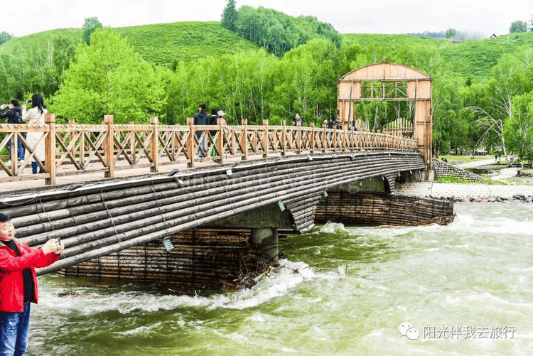
Mountaintop Platform of the Scenic Area -- After crossing the big wooden bridge, you are on the boardwalk to the mountaintop. This path is easy to walk, taking about half an hour to reach the top. The so-called mountaintop is actually a large, flat grassland where you can enjoy the surrounding scenery and see a panoramic view of Hemu Village in the distance. You can also ride a horse up and down the mountain, which is a choice for many tourists. Here is the view from the platform.
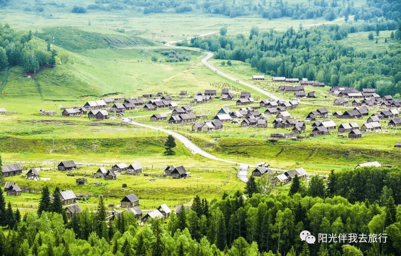
Dreamlike Scenery of Hemu Village -- Hemu Village is the farthest and largest of the three Tuva villages in Xinjiang (Hemu Village, Kanas Village, and Baihaba Village). All the houses in Hemu Village are built with logs, full of a primitive flavor. From the small hillsides around the village, you can look down on Hemu Village and see the misty bands of smoke rising from the chimneys. The scenery is dreamlike and more beautiful than a fairyland.
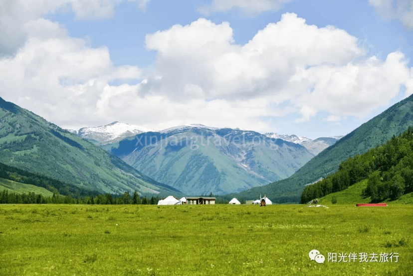
Here, the sightseeing tour of Hemu was over. We drove to the Kanas Airport and stayed at the Tianyuan Hotel at the airport.
We flew back to Urumqi from Kanas Airport early in the morning and arrived around noon. We then toured some of Urumqi's key attractions. The first was the Xinjiang Museum, the second was the Grand Bazaar, and the third was Hongshan Park. Here are some photos.
Xinjiang Museum -- Famous collections include the Loulan Beauty mummy.
Grand Bazaar -- This is the largest bazaar in the world, integrating Islamic culture, architecture, ethnic commerce, entertainment, and dining. It is a gathering place and showcase for Xinjiang's tourism products and is known as the "Window of Xinjiang."
Hongshan Park -- Located in the center of Urumqi, Hongshan Park integrates tourism, classical features, cultural significance, and sports. It is a national 4A-level tourist attraction and one of the "New Ten Scenic Spots of Urumqi." From the top of the small hill, you can overlook the Urumqi city skyline. There is also a large temple inside, which is a popular spot for temple fairs.
Watching "A Thousand Loops of the Western Regions" at the Xinjiang Grand Theatre -- If you have time in the evening, you can watch the iconic Xinjiang dance drama "A Thousand Loops of the Western Regions" at the Xinjiang Grand Theatre. The stage design of this drama is superb, integrating sound, light, color, and form. Using the entire theatre space as a stage for a three-dimensional performance, it allows you to experience the pinnacle of domestic stage play craftsmanship.

This concludes the 13-day comprehensive tour guide for Northern Xinjiang.

